 |
|
|
|
|
|
| |
| |
|
|
|
|
| |
| |
|
|
"Samuel Benge" <stb### [at] hotmail com> wrote:
> Attached is an image combining contour lines from "tamrielheightsmall.png"
> superimposed onto your relief map.
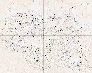
Tim, I must mention that I thickened every fifth line, just in case you were
wondering why their widths vary :) com> wrote:
> Attached is an image combining contour lines from "tamrielheightsmall.png"
> superimposed onto your relief map.
Tim, I must mention that I thickened every fifth line, just in case you were
wondering why their widths vary :)
Post a reply to this message
|
|
| |
| |
|
|
|
|
| |
| |
|
|
On 2012-10-17 20:20, Samuel Benge wrote:
> I noticed that your map uses elements of varying resolutions. Some parts are
> sharp, while others are quite pixelated.
I know...the underwater areas at the upper-left in particular are much
lower resolution than other places, and that's purely game-data issue.
I guess they thought nobody'd notice.
> My macro takes everything literally, so a line is just as likely to loop around
> a depression as it is a hill, it's just that depressions are less common and
> might be missed if the spacing is too wide.
That's what I meant; if you have a donut-shaped hill, so that it has two
concentric rings that are actually the same altitude, with the centre
being a divot, it will look identical to a hill that's taller and
crosses the next elevation line up.
Any way of checking the slope direction/comparing the height
before/after the contour line, then generating perpendicular
inward-pointing ticks for depressions?
XD
--
Tim Cook
http://empyrean.sjcook.com
Post a reply to this message
|
|
| |
| |
|
|
|
|
| |
| |
|
|
On 2012-10-17 21:19, Samuel Benge wrote:
> Attached is an image combining contour lines from "tamrielheightsmall.png"
> superimposed onto your relief map. The lines seem to behaving themselves. Is
> this anywhere near what you wanted? I sure hope I haven't sent you on a wild
> goose chase!
>
> Here's the POV scene used to trace it:
Oh...my. That's smexy. Think you did some modification to your macro
to do the index contours plus regulars from the version I snagged, v. nice.
Now to get to the minor tweaking. Running this at a stoopid-high
resolution, adding the shorelines/waterways, labelling...
--
Tim Cook
http://empyrean.sjcook.com
Post a reply to this message
|
|
| |
| |
|
|
|
|
| |
| |
|
|
> It should. The attached render uses a converted and eroded digital elevation
> model of Morongo Valley, CA (elevation lines were arbitrarily chosen).
This is an interesting render.
Paolo
Post a reply to this message
|
|
| |
| |
|
|
|
|
| |
| |
|
|
So, with the gracious assistance of Mr. Benge, I have been able to
progress by leaps and bounds, adding the initial pass of roads
(transcribed from the mod that adds those to the world map). I have
made some minor adjustments to make the roads better fit the terrain,
but not many; somewhat surprisingly (to me, at least), the roads in
Skyrim follow the contours of the land in a way that makes sense. Usually.
I had rendered the contour lines a bit light, I need to either rerender
or adjust in another layer. The landmark icons are the in-game ones,
and I need to verify/correct their locations, and replace them with
appropriate 'real' map symbols (or things that look as such). Think I
need to check on some of the roads, too, but...it's a great deal further
along than I had hoped to be.
When this is complete, the next logical stage will be to render the rest
of the terrain data and make a mod for Skyrim to display the topography
in its world map.
--
Tim Cook
http://empyrean.sjcook.com
Post a reply to this message
Attachments:
Download '2456219 skyrim topo.jpg' (946 KB)
Preview of image '2456219 skyrim topo.jpg'
|
|
| |
| |
|
|
|
|
| |
| |
|
|
Awesome.
Thomas
Post a reply to this message
|
|
| |
| |
|
|
|
|
| |
| |
|
|
>Tim Cook on date 18/10/2012 19.28 wrote:
> So, with the gracious assistance of Mr. Benge, I have been able to
> progress by leaps and bounds, adding the initial pass of roads
> (transcribed from the mod that adds those to the world map). I have
> made some minor adjustments to make the roads better fit the terrain,
> but not many; somewhat surprisingly (to me, at least), the roads in
> Skyrim follow the contours of the land in a way that makes sense. Usually.
>
> I had rendered the contour lines a bit light, I need to either rerender
> or adjust in another layer. The landmark icons are the in-game ones,
> and I need to verify/correct their locations, and replace them with
> appropriate 'real' map symbols (or things that look as such). Think I
> need to check on some of the roads, too, but...it's a great deal further
> along than I had hoped to be.
>
> When this is complete, the next logical stage will be to render the rest
> of the terrain data and make a mod for Skyrim to display the topography
> in its world map.
>
> --
> Tim Cook
> http://empyrean.sjcook.com
This is an intriguing map!
Paolo
Post a reply to this message
|
|
| |
| |
|
|
|
|
| |
| |
|
|
Paolo Gibellini <p.g### [at] gmailcom> wrote:
> > It should. The attached render uses a converted and eroded digital elevation
> > model of Morongo Valley, CA (elevation lines were arbitrarily chosen).
> This is an interesting render.
> Paolo
That about describes it, because it's certainly not accurate. Besides
arbitrarily placing the contours, I'd managed to accidently get the map both
flipped horizontally and rotated 180 degrees. You'd think after all these years,
I'd know better! :P
Post a reply to this message
|
|
| |
| |
|
|
|
|
| |
| |
|
|
Tim Cook <z99### [at] gmailcom> wrote:
> So, with the gracious assistance of Mr. Benge, I have been able to
> progress by leaps and bounds, adding the initial pass of roads
> (transcribed from the mod that adds those to the world map). I have
> made some minor adjustments to make the roads better fit the terrain,
> but not many; somewhat surprisingly (to me, at least), the roads in
> Skyrim follow the contours of the land in a way that makes sense. Usually.
>
> I had rendered the contour lines a bit light, I need to either rerender
> or adjust in another layer. The landmark icons are the in-game ones,
> and I need to verify/correct their locations, and replace them with
> appropriate 'real' map symbols (or things that look as such). Think I
> need to check on some of the roads, too, but...it's a great deal further
> along than I had hoped to be.
>
> When this is complete, the next logical stage will be to render the rest
> of the terrain data and make a mod for Skyrim to display the topography
> in its world map.
It's looking good, Tim. Seems like it would be a fun place to explore. Are the
elevation lines in sync with Skyrim's sense of altitude?
Post a reply to this message
|
|
| |
| |
|
|
|
|
| |
| |
|
|
On 2012-10-19 15:34, Samuel Benge wrote:
> It's looking good, Tim. Seems like it would be a fun place to explore. Are the
> elevation lines in sync with Skyrim's sense of altitude?
The in-game scale is 128 units = 6 feet, and the Throat of the World
being at 21600 units above sea level. That comes to 1012.5 feet...a bit
short (Mt. Everest (er, Qomolongma) is 4.7 miles).
HOWEVER, if you look at the scale of things /along the ground/, the
horizontal distance between Dawnstar and Winterhold is about 61350
units. That'd be 2867 feet (bit over half a mile). Per canon (near as
I can tell, if this other map is accurate), it should be about 75 miles.
So horizontally it's off by let's say a factor of 40 (I'd previously
calculated it to 10, so need to fix my scale), and if you scale up the
verticals by the same amount, that puts the Throat of the World at 7.67
miles. So...let's say vertical exaggeration of 25x, puts the highest
peak on Nirn at 4.79 miles, and the lowest depth (on the map I have) at
25290 units below sea level, or 5.61 miles adjusting for the 25x factor
(Challenger Deep on Earth is 6.85 miles).
So I need to rerender after figuring... Total altitude range is 46890
units, which ends up being 54949 feet...let's say 55,000 feet. Calling
the macro with 11 would give 5000-foot indexes. (Had used 13 and change
on my current version).
--
Tim Cook
http://empyrean.sjcook.com
Post a reply to this message
|
|
| |
| |
|
|
|
|
| |


