 |
 |
|
 |
|
 |
|  |
|  |
|
 |
|
 |
|  |
|  |
|
 |
High!
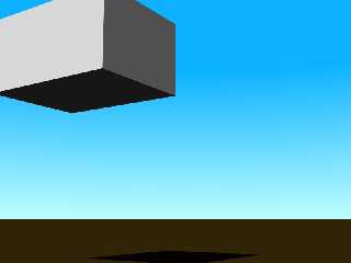
Second day of the PoVEarth project... meanwhile, I calculated the
coordinates for the Local Model, added a ground plane (with a simple
standard texture for bare soil) and placed the apartment box
(provisionally) 6.4 metres above it. Now also the sky is no longer
completely stupid, it looks remotely like a fine day on Terra...
The camera position is that of a pedestrian standing in the middle of
the suburban side street where I live, looking south-eastward.
Watch out for more!
See you in Khyberspace!
Yadgar
Post a reply to this message
Attachments:
Download '.jpg' (16 KB)
Preview of image '.jpg'

|
 |
|  |
|  |
|
 |
|
 |
|  |
|  |
|
 |
=?ISO-8859-15?Q?J=F6rg_=27Yadgar=27_Bleimann?= <yaz### [at] gmx de> wrote:
> High!
>
> Second day of the PoVEarth project... meanwhile, I calculated the
> coordinates for the Local Model, added a ground plane (with a simple
> standard texture for bare soil) and placed the apartment box
> (provisionally) 6.4 metres above it. Now also the sky is no longer
> completely stupid, it looks remotely like a fine day on Terra...
>
> The camera position is that of a pedestrian standing in the middle of
> the suburban side street where I live, looking south-eastward.
>
> Watch out for more!
>
> See you in Khyberspace!
>
> Yadgar
Are you planning on placing your objects via script or macro, and are you using
a modeling tool?
Before I started experimenting with wings3d, I found complex shapes
prohibitively hard to produce by hand via SDL/
-Reactor de> wrote:
> High!
>
> Second day of the PoVEarth project... meanwhile, I calculated the
> coordinates for the Local Model, added a ground plane (with a simple
> standard texture for bare soil) and placed the apartment box
> (provisionally) 6.4 metres above it. Now also the sky is no longer
> completely stupid, it looks remotely like a fine day on Terra...
>
> The camera position is that of a pedestrian standing in the middle of
> the suburban side street where I live, looking south-eastward.
>
> Watch out for more!
>
> See you in Khyberspace!
>
> Yadgar
Are you planning on placing your objects via script or macro, and are you using
a modeling tool?
Before I started experimenting with wings3d, I found complex shapes
prohibitively hard to produce by hand via SDL/
-Reactor
Post a reply to this message
|
 |
|  |
|  |
|
 |
|
 |
|  |
|  |
|
 |
High!
Reactor schrieb:
> Are you planning on placing your objects via script or macro, and are you using
> a modeling tool?
> Before I started experimenting with wings3d, I found complex shapes
> prohibitively hard to produce by hand via SDL/
For curved structures such as roads and sidewalks, I probably will use a
Python script converting GIMP bezier paths into PoV-Ray splines... but
more rectangular structures (like most buildings), for the time being, I
could do with simple CSG!
See you on www.khyberspace.de!
Yadgar
Post a reply to this message
|
 |
|  |
|  |
|
 |
|
 |
|  |
|  |
|
 |
> For curved structures such as roads and sidewalks, I probably will use a
> Python script converting GIMP bezier paths into PoV-Ray splines... but
> more rectangular structures (like most buildings), for the time being, I
> could do with simple CSG!
BTW, you should familiarize yourself with scaling issues and
floating point accuracy if those buildings are then intended
to be placed on an earth-sized sphere.
Post a reply to this message
|
 |
|  |
|  |
|
 |
|
 |
|  |
|  |
|
 |
High!
Christian Froeschlin schrieb:
> BTW, you should familiarize yourself with scaling issues and
> floating point accuracy if those buildings are then intended
> to be placed on an earth-sized sphere.
In fact, I did!
// SCALE LEVEL VIEW FLAGS
#declare cosmic=0;
#declare global=0;
#declare regional=0;
#declare loc=1;
#declare microloc=0;
[...]
// SCALING FACTORS
#if (cosmic)
#declare f=100000; // 1 POV unit = 100 kilometres
#else
#if (global)
#declare f=1000; // 1 POV unit = 1 kilometre
#else // regional, local and microlocal view
#declare f=1; // 1 POV unit = 1 metre
#if (regional)
#else
#if (loc)
#declare trans=<247.38, 0, 248>/f; // coordinate origin for
local model
#end
#end
#end
#end
// end of listing slice
I'm pretty aware that in the "global" model, the smallest object to be
rendered correctly will be about 1 km/12500 = 8 cms across... probably I
will "fine-tune" the scaling factors later on! In the long run, we also
could hope for a smaller epsilon value with the version 4.0 - and, of
course, faster CPUs!
See you in Khyberspace!
Yadgar
Post a reply to this message
|
 |
|  |
|  |
|
 |
|
 |
|  |
|
 |


![]()