|
|
|
|
|
|
| |
| |
|
|
|
|
| |
| |
|
|
> The water seems to be above the surface. Also, stream patterns do not
> take the underlying landscape into account, with patterns happily
> crossing peaks. I guess that the pattern was not derived from this
> particular landscape but was just superposed on it for testing's sake.
> Using a flow map generated from a particular landscape that would be
> possible to do indeed. Wilbur, amongst others, can make such maps.
>
> --
> Thomas
Well, I certainly make no promises that anything is really obeying the laws of
physics, but I think the main problem with the images is some artifacts around
the edges of the terrain that make it difficult to understand where the light is
coming from. There are things that look like shadows that are actually the
repeating edge of the height map coming though.
Post a reply to this message
Attachments:
Download 'together2.png' (2832 KB)
Preview of image 'together2.png'
|
|
| |
| |
|
|
|
|
| |
| |
|
|
Thomas de Groot <tho### [at] degroot org> wrote:
> On 23-2-2017 16:12, Kirk Andrews wrote:
> > Would you be willing to share some of your eroded landscape height maps?
> >
>
> They can be found now in p.b.misc. I had to convert them from tga to png
> in order to reduce the size. But they work the same.
>
> There was one example of a degenerate cylinder crashing the scene. Some
> control on the hf margins seems to be necessary.
>
> --
> Thomas
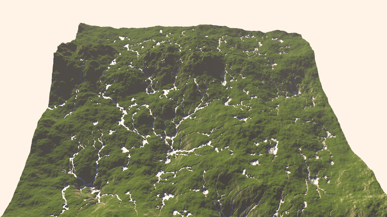
Thanks for sharing those, Thomas. I'm pretty happy with the way the streams are
flowing on a terrain with erosion factored in! org> wrote:
> On 23-2-2017 16:12, Kirk Andrews wrote:
> > Would you be willing to share some of your eroded landscape height maps?
> >
>
> They can be found now in p.b.misc. I had to convert them from tga to png
> in order to reduce the size. But they work the same.
>
> There was one example of a degenerate cylinder crashing the scene. Some
> control on the hf margins seems to be necessary.
>
> --
> Thomas
Thanks for sharing those, Thomas. I'm pretty happy with the way the streams are
flowing on a terrain with erosion factored in!
Post a reply to this message
Attachments:
Download 'water4_tghf_1.png' (3875 KB)
Preview of image 'water4_tghf_1.png'

|
|
| |
| |
|
|
|
|
| |
| |
|
|
"Kirk Andrews" <kir### [at] tektonartcom> wrote:
> Thomas de Groot <tho### [at] degrootorg> wrote:
> > On 23-2-2017 16:12, Kirk Andrews wrote:
> > > Would you be willing to share some of your eroded landscape height maps?
> > >
> >
> > They can be found now in p.b.misc. I had to convert them from tga to png
> > in order to reduce the size. But they work the same.
> >
> > There was one example of a degenerate cylinder crashing the scene. Some
> > control on the hf margins seems to be necessary.
> >
> > --
> > Thomas
>
> Thanks for sharing those, Thomas. I'm pretty happy with the way the streams are
> flowing on a terrain with erosion factored in!
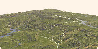
Yep, that's good. Other rendering before this really shows the correct stream
flow for elevation, too. Thanks for that, I won't try and look at the other
again to save my eyes/brain. LOL
Post a reply to this message
|
|
| |
| |
|
|
|
|
| |
| |
|
|
On 25-2-2017 17:30, Kirk Andrews wrote:
> Well, I certainly make no promises that anything is really obeying the laws of
> physics, but I think the main problem with the images is some artifacts around
> the edges of the terrain that make it difficult to understand where the light is
> coming from. There are things that look like shadows that are actually the
> repeating edge of the height map coming though.
>
This is looking very realistic indeed. Although some elements are a bit
counter-intuitive, especially lake bottoms, the overall impression is
very convincing. Well done!
--
Thomas
Post a reply to this message
|
|
| |
| |
|
|
|
|
| |
| |
|
|
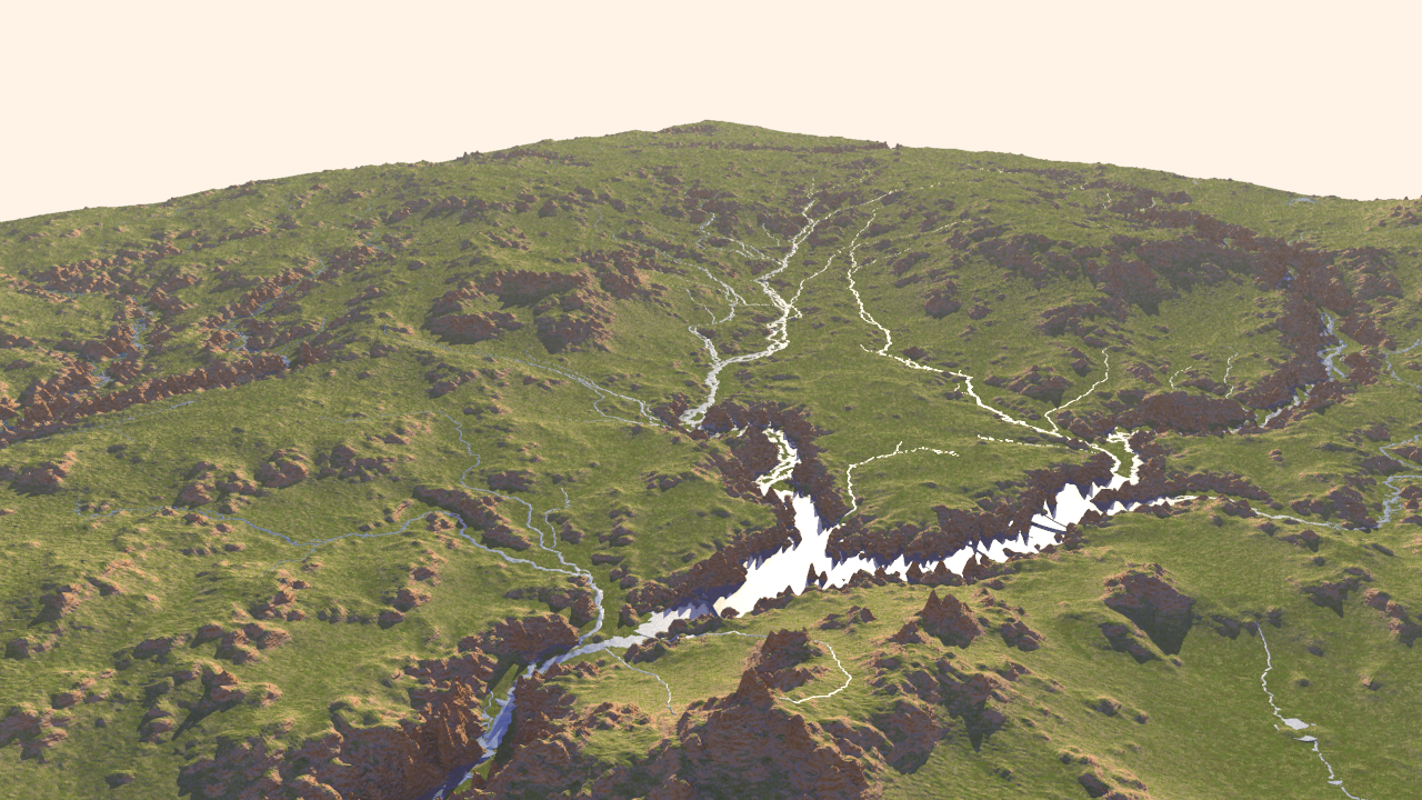
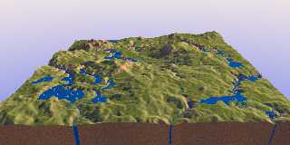
On 25-2-2017 21:09, Kirk Andrews wrote:
> Thanks for sharing those, Thomas. I'm pretty happy with the way the streams are
> flowing on a terrain with erosion factored in!
>
Nice! I especially like those little islands in the streams. Version 4
is doing a good job in any case.
--
Thomas
Post a reply to this message
|
|
| |
| |
|
|
|
|
| |
| |
|
|
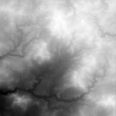
> "Kirk Andrews" <kir### [at] tektonartcom> wrote:
>> "omniverse" <omn### [at] charternet> wrote:
>>>
>>> Has me wondering if erosion could be accomplished via difference {} using
>>> likewise cone+sphere stream/lake creation method.
>>
>> Looks like that was something I was trying out, back in 2008. Looks like I was
>> rendering out a flat image of just the rivers to be subtracted from the height
>> map image.
> Sure does mess with my eyes! I turned it upside down, sideways too, and those
> shadows just wouldn't get right for me.
>
> Maybe I'm seeing it wrong but the tributaries appear to begin or end at the
> lower elevations with pooling water at the higher elevations.
>
> Does give the appearance of eroded ground anyhow regardless of how I see it.
>
>
I see it the same. Water accumulating on/flowing toward the highest parts.
Post a reply to this message
|
|
| |
| |
|
|
|
|
| |
| |
|
|
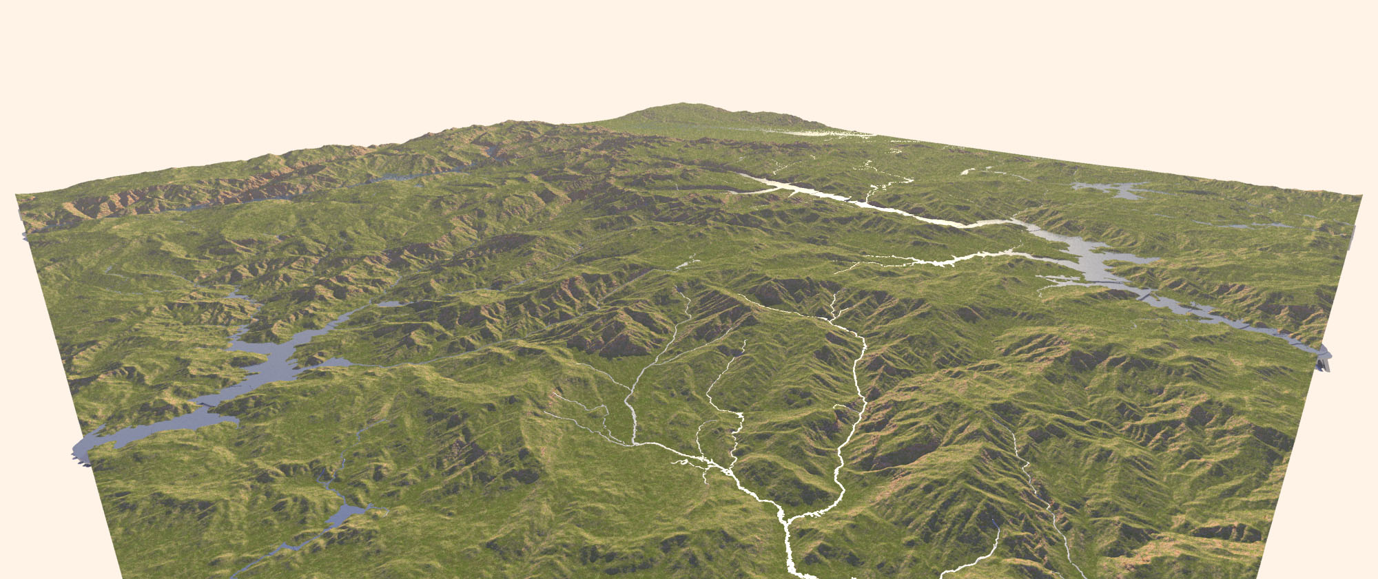
I found some real world height maps. I was sure they were out there, but I was
having trouble actually finding them previously.
If you're interested, I got them from https://earthexplorer.usgs.gov/ (follow
instructions from http://gisgeography.com/free-global-dem-data-sources/)
Post a reply to this message
Attachments:
Download 'water4_usgs.jpg' (322 KB)
Preview of image 'water4_usgs.jpg'
|
|
| |
| |
|
|
|
|
| |
| |
|
|
On 27-2-2017 4:05, Kirk Andrews wrote:
> I found some real world height maps. I was sure they were out there, but I was
> having trouble actually finding them previously.
>
> If you're interested, I got them from https://earthexplorer.usgs.gov/ (follow
> instructions from http://gisgeography.com/free-global-dem-data-sources/)
>
Thanks. Good reminder. I used those data in a distant past indeed... ;-)
--
Thomas
Post a reply to this message
|
|
| |
| |
|
|
|
|
| |
| |
|
|
On 27-2-2017 4:05, Kirk Andrews wrote:
> I found some real world height maps. I was sure they were out there, but I was
> having trouble actually finding them previously.
>
A few other sites of interest:
https://www.ngdc.noaa.gov/mgg/topo/globe.html or
https://www.ngdc.noaa.gov/mgg/global/seltopo.html
http://www.viewfinderpanoramas.org/dem3.html
--
Thomas
Post a reply to this message
|
|
| |
| |
|
|
|
|
| |
| |
|
|
Investigating further into version 4. Attached is (1) a new version of
one of the previous height_fields, with more blur applied; (2) the
rendered landscape with streams. There are a couple of instances where
the ponding is showing its edge when the surface dips too steeply away
(I guess): foreground left and right (look at the shadows).
[I still cannot understand what makes the "water pillars" shown in
previous images. Maybe to do with completely flat surfaces and the
edges? I am not sure where to look in the code to get a true grip on them.]
--
Thomas
Post a reply to this message
Attachments:
Download 'wilbur_weatheredchasm_02.png' (375 KB)
Download 'ka_water4.jpg' (183 KB)
Preview of image 'wilbur_weatheredchasm_02.png'
Preview of image 'ka_water4.jpg'
|
|
| |
| |
|
|
|
|
| |