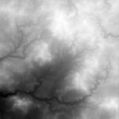
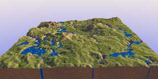
Investigating further into version 4. Attached is (1) a new version of
one of the previous height_fields, with more blur applied; (2) the
rendered landscape with streams. There are a couple of instances where
the ponding is showing its edge when the surface dips too steeply away
(I guess): foreground left and right (look at the shadows).
[I still cannot understand what makes the "water pillars" shown in
previous images. Maybe to do with completely flat surfaces and the
edges? I am not sure where to look in the code to get a true grip on them.]
--
Thomas
Post a reply to this message
Attachments:
Download 'wilbur_weatheredchasm_02.png' (375 KB)
Download 'ka_water4.jpg' (183 KB)
Preview of image 'wilbur_weatheredchasm_02.png'
Preview of image 'ka_water4.jpg'
|