|
|
|
|
|
|
| |
| |
|
|
|
|
| |
| |
|
|
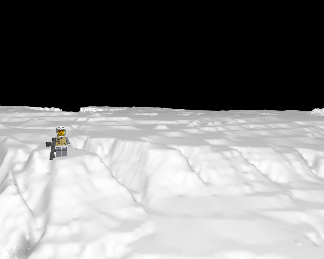
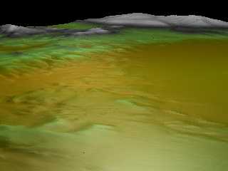
Landscape.tga (snow) for rebel_snowspeeder not found but found the grandcanyon.
http://www.programmersheaven.com/download/1799/10/ZipView.aspx
http://www.programmersheaven.com/download/1799/download.aspx
http://www.travelnotes.de/rays/grandcan/index.htm
http://edc2.usgs.gov/geodata/index.php
http://edcftp.cr.usgs.gov/pub/data/DEM/250/G/
:actually:GrandCanyon e-w
\scenes3\dem>dem2pov gce.dem gce.tga
Enter 0 for all, 1 for samples, 2 for subset : 0
Height-field type (0) Actual heights (1) Normalized : 1
Enter elevation bias: 0
Enter default elevation (final output units) : 0
TGA header width = 1201 height = 1201
1442401 pixels were written to the file.
For converted data points:
MinValue = 12654.397 MaxValue = 65535.000
gcw=For converted data points:
MinValue = 7249.793 MaxValue = 65535.000
height_field { tga "gce.tga" smooth
scale <1000, 100, 1000>*10
translate <-500, -100,0>*10
texture {
pigment { color white }
finish { ambient 0.6 reflection 0 diffuse 0.4 }
}
}
DEM2POV v1.2a
Converts USGS Digital Elevation Model data files to tga height-field
Post a reply to this message
Attachments:
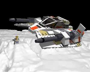
Download 'rebel_snowspeeder.png' (274 KB)
Preview of image 'rebel_snowspeeder.png'

|
|
| |
| |
|
|
|
|
| |
| |
|
|
kirkland
Post a reply to this message
Attachments:
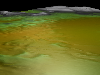
Download 'hftest.png' (81 KB)
Preview of image 'hftest.png'
|
|
| |
| |
|
|
|
|
| |
| |
|
|
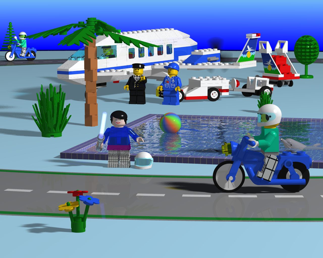
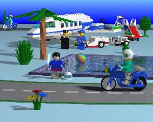
StarLiner with prop blur
Post a reply to this message
Attachments:
Download 'liner-pool.jpg' (165 KB)
Preview of image 'liner-pool.jpg'
|
|
| |
| |
|
|
|
|
| |
| |
|
|
alphaQuad wrote:
> DEM2POV v1.2a
>
> Converts USGS Digital Elevation Model data files to tga height-field
Heh - I wish I'd found that a couple of weeks ago :-)
I couldn't find anything that could convert hgt files so I hacked a
quick java program to convert hgt to pgm. All my program needed to do
was add the PGM header as otherwise the formats are the same.
It would have been fairly quick but it turned out that POV-Ray is very
fussy about what type of whitespaces you use in the pgm header gah.
Pov seems to expect you to use newlines everywhere except between the
width and height (where you should use a space), but I didn't know this
so at first I just used spaces everywhere.
Post a reply to this message
|
|
| |
| |
|
|
|
|
| |
| |
|
|
Verm <a@b> wrote:
> alphaQuad wrote:
> > DEM2POV v1.2a
> >
> > Converts USGS Digital Elevation Model data files to tga height-field
>
> Heh - I wish I'd found that a couple of weeks ago :-)
>
> I couldn't find anything that could convert hgt files so I hacked a
> quick java program to convert hgt to pgm. All my program needed to do
> was add the PGM header as otherwise the formats are the same.
>
> It would have been fairly quick but it turned out that POV-Ray is very
> fussy about what type of whitespaces you use in the pgm header gah.
> Pov seems to expect you to use newlines everywhere except between the
> width and height (where you should use a space), but I didn't know this
> so at first I just used spaces everywhere.
Sorry 'bout that, I'm just a few weeks behind, but stay tuned I catch up
quickly.
Post a reply to this message
Attachments:
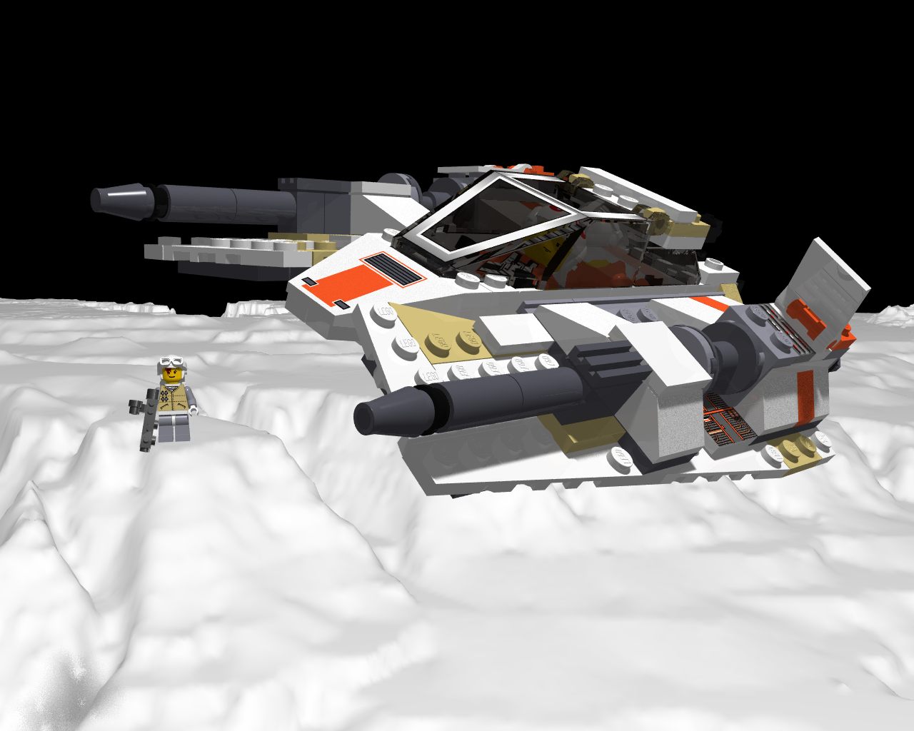
Download 'rebel_snowspeeder.jpg' (103 KB)
Preview of image 'rebel_snowspeeder.jpg'
|
|
| |
| |
|
|
|
|
| |
| |
|
|
Verm <a@b> wrote:
> alphaQuad wrote:
> > DEM2POV v1.2a
> >
> > Converts USGS Digital Elevation Model data files to tga height-field
>
> Heh - I wish I'd found that a couple of weeks ago :-)
I could have used it several *years* ago (August 2004 according to my bookmark).
Now I've forgotten what I needed it for. :-(
_________________
(I can also use some device that would keep my Internet from crashing every few
hours and/or minutes, especially while I'm in the middle of posting something.
Now I have to copy this to Notepad and save it lest I accidentally close it
during however many minutes and/or hours it takes for the Internet to come back
on-line. Of course, by then my login will have expired...
This happens several times per day.
This is supposedly the top-rated Internet service in the Virgin Islands.
Something is very wrong.)
Post a reply to this message
|
|
| |
| |
|
|
From: Nicolas Alvarez
Subject: Re: Digital Elevation Model-grandCanyon
Date: 27 Jan 2009 15:41:56
Message: <497f7193@news.povray.org>
|
|
|
| |
| |
|
|
Cousin Ricky wrote:
> (I can also use some device that would keep my Internet from crashing
> every few hours and/or minutes, especially while I'm in the middle of
> posting something. Now I have to copy this to Notepad and save it lest I
> accidentally close it during however many minutes and/or hours it takes
> for the Internet to come back on-line. Of course, by then my login will
> have expired...
Use a real newsreader instead of the web interface. Then posts stay
in "Outbox" until your Internet comes back.
Post a reply to this message
|
|
| |
| |
|
|
|
|
| |