|
|
|
|
|
|
| |
| |
|
|
|
|
| |
| |
|
|
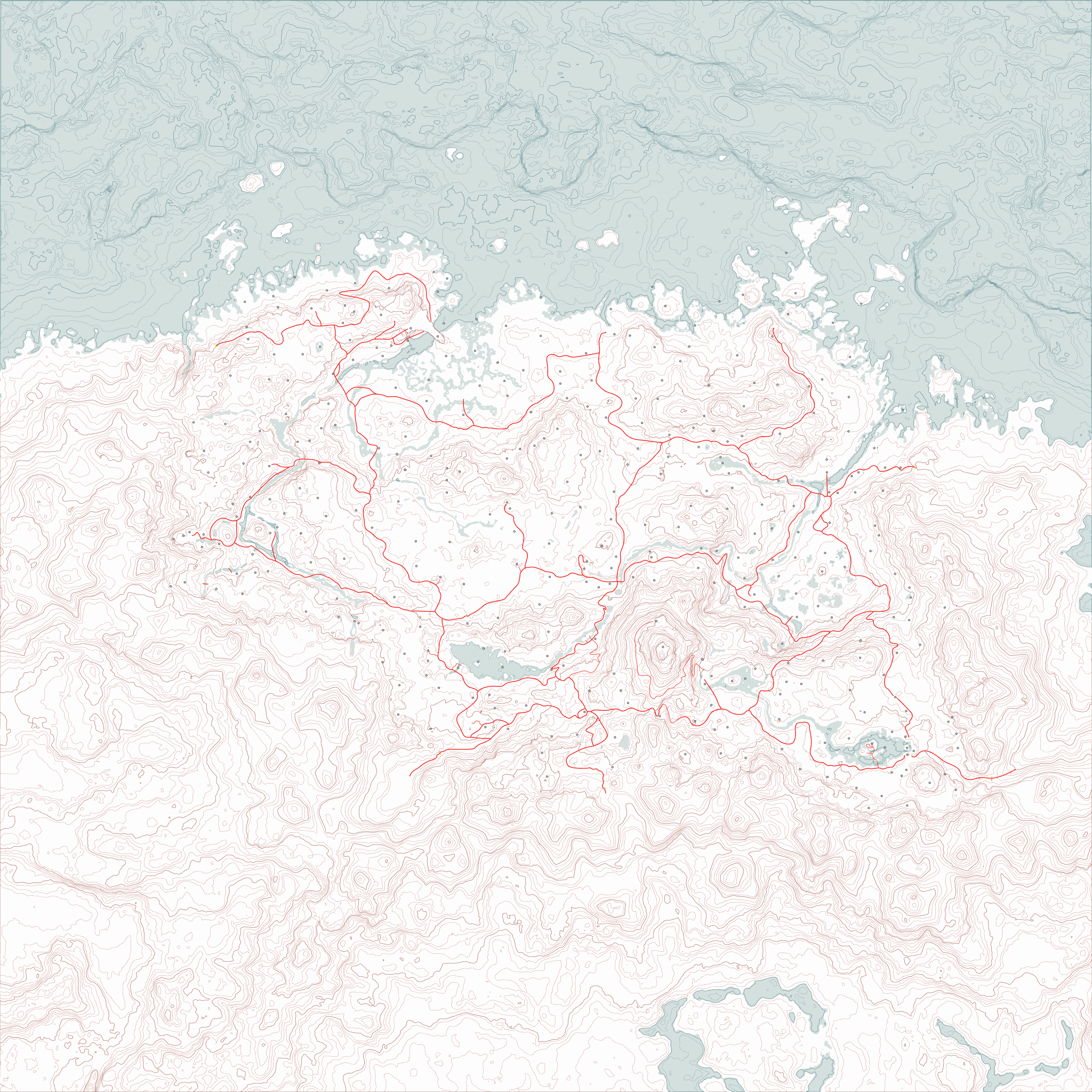
And here's a sized-down version of the current version of the map.
Turns out an 8192x8192 image isn't something my computer is particularly
happy about being asked to work with, with multiple layers (even vector)
in an image editor.
I yet need to go in and do the shoreline and water features, swap out
the placeholder dots with map symbols, add the secondary and tertiary
roads, the borders, expand into Cyrodiil, High Rock, Hammerfell, and
Morrowind, add the canon cities from Skyrim that were left out of Skyrim
the game, maybe mark the forested areas...oh yeah and add labels to
everything.
--
Tim Cook
http://empyrean.sjcook.com
Post a reply to this message
Attachments:
Download 'tamriel topo 2048.png' (762 KB)
Preview of image 'tamriel topo 2048.png'
|
|
| |
| |
|
|
|
|
| |
| |
|
|
Tim Cook <z99### [at] gmail com> wrote:
> And here's a sized-down version of the current version of the map.
> Turns out an 8192x8192 image isn't something my computer is particularly
> happy about being asked to work with, with multiple layers (even vector)
> in an image editor.
Looks good. Red lines are paved roads, yes?
Is it worth trying to convert this to a vector format, svg or something? This
type of graphic cries out to be in a non-bitmap form.
Bill com> wrote:
> And here's a sized-down version of the current version of the map.
> Turns out an 8192x8192 image isn't something my computer is particularly
> happy about being asked to work with, with multiple layers (even vector)
> in an image editor.
Looks good. Red lines are paved roads, yes?
Is it worth trying to convert this to a vector format, svg or something? This
type of graphic cries out to be in a non-bitmap form.
Bill
Post a reply to this message
|
|
| |
| |
|
|
|
|
| |
| |
|
|
On 2012-10-25 02:26, Bill Pragnell wrote:
> Looks good. Red lines are paved roads, yes?
Thicker ones, yes. Started adding a few secondary unpaved roads; 7000
Steps up to High Hrothgar in particular was missing in the map mod I
had, so I had to compile and use the UESP wiki's map (which is much
better reference).
> Is it worth trying to convert this to a vector format, svg or something? This
> type of graphic cries out to be in a non-bitmap form.
Ah yeah, svg might be a better format to use than psp. I don't want to
hand-trace and optimize all the contour lines, though. :( The
coastline and waterways stage is going to be enough of a nuisance. Any
program that can do that for me?
It would massively reduce the file size.
Also note: the image should be able to be chopped up and converted into
.dds files and used as the in-game map, at this point. There's a bit of
distortion due to my initial rendering of the height map from Moray,
which doesn't have the orthographic camera type, but it should be minor.
--
Tim Cook
http://empyrean.sjcook.com
Post a reply to this message
|
|
| |
| |
|
|
|
|
| |
|
|