|
 |
Using a little but powerful program called MacDEM, I merged nine USGS
7.5-minute DEM quadrangles to span an area some fifteen or twenty miles
square. These merged DEMS were written to a 24-bit Targa file along with an
accompanying scene file with the correct scaling for the height field.
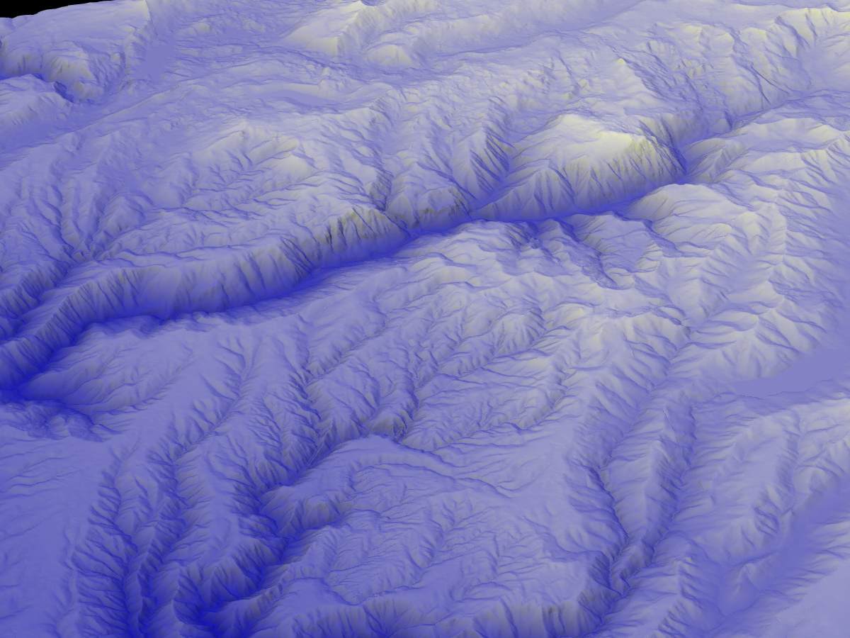
This is in California's Sierra Nevada, west of Lake Tahoe. The most
prominent canyon is that of the North Fork American River. It is over three
thousand feet deep. The view is from the south looking north. Various
canyons in the Middle Fork American are also in view, as is the South Yuba,
and the upper Bear River. I-80 traverses this part of the Sierra--but it
stays well away from the North Fork canyon. Fortunately.
There is no vertical exagerration. A color map was applied giving dark blue
to the least elevations, and white to the highest--there is a range of
about six thousand feet in the landscape.
A blue light sines form straight above, and a yellow light from the
southwest.
I use these landscape renderings to help understand local geology and
geomorphology. One can often see changes in bedrock, or the difference
between glacial, or purely fluvial, erosion regimes. This contrast is
visible in the accompanying image: to the east north (right and up), the
terrain was severely glaciated; to the west and south, the ice never
reached, but the meltwater from the glaciers and ice caps rapidly deepened
and oversteepened the canyons.
Post a reply to this message
Attachments:
Download 'northforkeast.jpg' (100 KB)
Preview of image 'northforkeast.jpg'
|
|