|
 |
Tim Cook <z99### [at] bellsouth net> wrote:
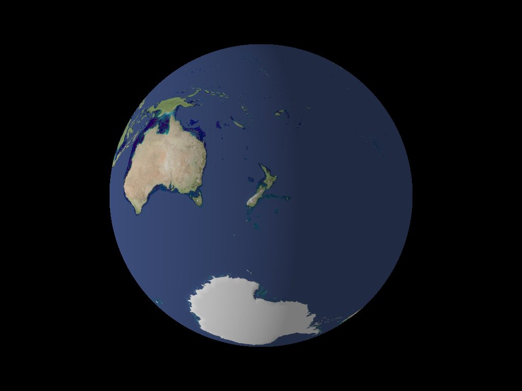
> Her's the Earth, looking at Australia.
Funny,
I'm going to leave the discussion topic a bit, but
just by chance I downloaded the 8km/pixel file of July before I read this
thread. And as all these Blue Marble pictures are Mercator projections, I
thought it was a good idea to...
Well, two continents one thought...
The original satellite image was more a _Black_ Marble to me, so I made it a
bit lighter (Photopaint).
But when I saw your image I thought: "Hey let's give the NZers a chance!",
and changed from my home coordinates:
// Latitude
//rotate 9.93948843330146 * y // East is Plus
// Longitude
//rotate -53.584204427898 * x // North is Minus
To the coords of Christchurch
rotate (-90 + 172.66) * y
rotate 43.5 * x
But anyway, I've got two questions:
These deep sea trenches west of Australia won't show up. Did you made them
afterwards?
And how did you do the athmosperic rim - a second sphere filled with media?
Yours,
Bu. net> wrote:
> Her's the Earth, looking at Australia.
Funny,
I'm going to leave the discussion topic a bit, but
just by chance I downloaded the 8km/pixel file of July before I read this
thread. And as all these Blue Marble pictures are Mercator projections, I
thought it was a good idea to...
Well, two continents one thought...
The original satellite image was more a _Black_ Marble to me, so I made it a
bit lighter (Photopaint).
But when I saw your image I thought: "Hey let's give the NZers a chance!",
and changed from my home coordinates:
// Latitude
//rotate 9.93948843330146 * y // East is Plus
// Longitude
//rotate -53.584204427898 * x // North is Minus
To the coords of Christchurch
rotate (-90 + 172.66) * y
rotate 43.5 * x
But anyway, I've got two questions:
These deep sea trenches west of Australia won't show up. Did you made them
afterwards?
And how did you do the athmosperic rim - a second sphere filled with media?
Yours,
Bu.
Post a reply to this message
Attachments:
Download 'nzers.jpg' (30 KB)
Preview of image 'nzers.jpg'
|
|