|
|
|
|
|
|
| |
| |
|
|
|
|
| |
| |
|
|
Following the discussion p.a-u on how to generate sediment layering
without immediately requiring the use of isosurfaces, I have been
playing a bit with different ideas.

First, in order to focus on something tangible, I got two Real World
examples:
https://geologylearn.blogspot.com/2015/11/sedimentary-structures.html
https://blogs.egu.eu/divisions/ts/2019/12/27/features-from-the-field-bedding-stratification/

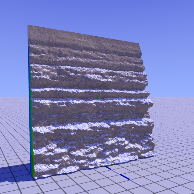
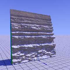
Then, I used Gimp to draw a rough b/w image. This image I loaded into
GeoControl, my old heightfield generator, and exported a .tga image_map
that I could use as height_field in POV.

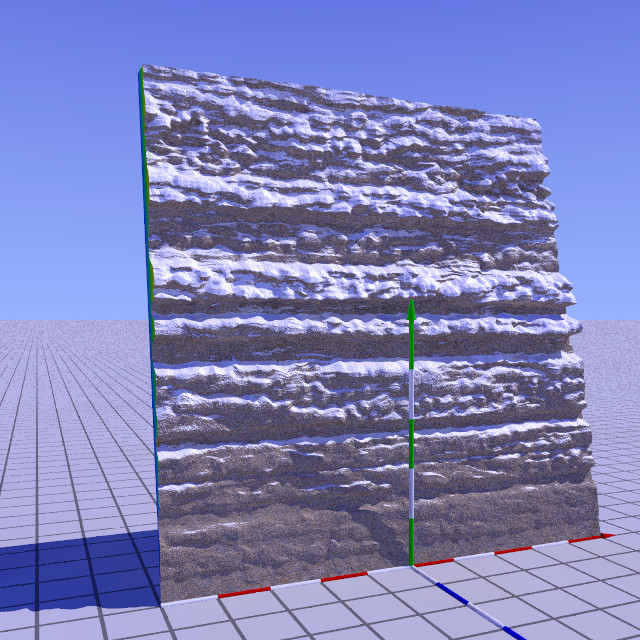
A tentative result is attached here. Not bad for a first,I think. :-)

Note: Jaime Vives Piqueres is the author of hf2iso. I can recommend it
if you want to play with isosurface landscapes.

--
Thomas
Post a reply to this message
Attachments:
Download 'hf_sedimentary_test.png' (486 KB)
Preview of image 'hf_sedimentary_test.png'
|
|
| |
| |
|
|
|
|
| |
| |
|
|
Op 18/09/2023 om 15:04 schreef Thomas de Groot:
> Note: Jaime Vives Piqueres is the author of hf2iso. I can recommend it
> if you want to play with isosurface landscapes.
>

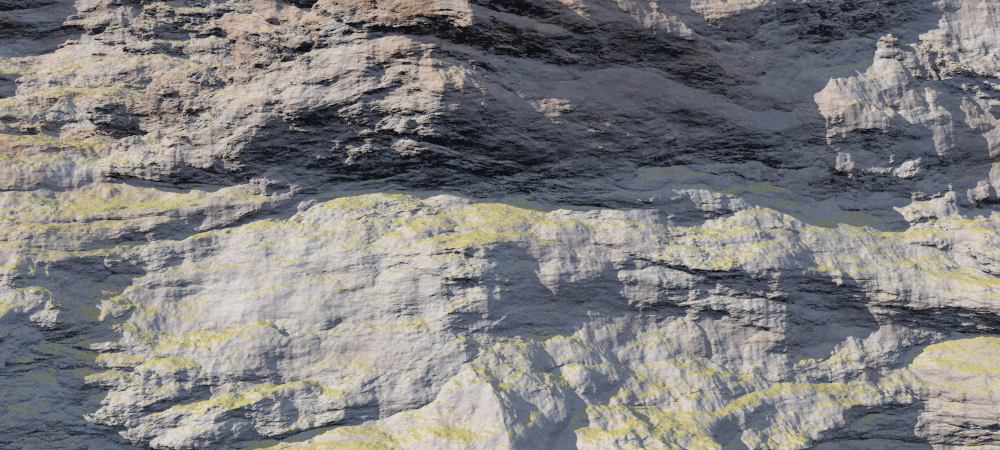
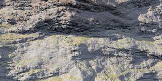
As an illustration of this, I include here an example rock face I
rendered while testing, back in 2020.

--
Thomas
Post a reply to this message
Attachments:
Download 'hf2iso_tga_ng3.png' (919 KB)
Preview of image 'hf2iso_tga_ng3.png'
|
|
| |
| |
|
|
|
|
| |
| |
|
|
Thomas de Groot <tho### [at] degroot org> wrote:
> Following the discussion p.a-u on how to generate sediment layering
> without immediately requiring the use of isosurfaces, I have been
> playing a bit with different ideas.
>
> First, in order to focus on something tangible, I got two Real World
> examples:
> https://geologylearn.blogspot.com/2015/11/sedimentary-structures.html
>
https://blogs.egu.eu/divisions/ts/2019/12/27/features-from-the-field-bedding-stratification/
>
> Then, I used Gimp to draw a rough b/w image. This image I loaded into
> GeoControl, my old heightfield generator, and exported a .tga image_map
> that I could use as height_field in POV.
>
> A tentative result is attached here. Not bad for a first,I think. :-)
>
> Note: Jaime Vives Piqueres is the author of hf2iso. I can recommend it
> if you want to play with isosurface landscapes.
>
> --
> Thomas
It looks very promising, Thomas! Any idea yet how you would go about
constructing an entire feature (e.g. cliffside in a landscape)?
The links you posted are quite inspiring. The first image in the first link is
something I've tried to do, but always seem to fail at. Later on that page, I
was amazed to see that sand ripples could be captured in such a way.
Ultimately, nothing will beat a full 3d simulation using voxels or similar, but
who's got the hardware for that? (Or the algorithms? ;P)
Btw, they mentioned Zion National Park. Did you ever get to go there? I was
there when I was six, on a road trip my dad took us on when following a
meandering path to Montana. Zion was my favorite out of all the places we
visited. The reddish cliffs were pure eye candy. I was hoping to see some desert
sandstone plateaus, but we never passed through any such areas :(
Sam org> wrote:
> Following the discussion p.a-u on how to generate sediment layering
> without immediately requiring the use of isosurfaces, I have been
> playing a bit with different ideas.
>
> First, in order to focus on something tangible, I got two Real World
> examples:
> https://geologylearn.blogspot.com/2015/11/sedimentary-structures.html
>
https://blogs.egu.eu/divisions/ts/2019/12/27/features-from-the-field-bedding-stratification/
>
> Then, I used Gimp to draw a rough b/w image. This image I loaded into
> GeoControl, my old heightfield generator, and exported a .tga image_map
> that I could use as height_field in POV.
>
> A tentative result is attached here. Not bad for a first,I think. :-)
>
> Note: Jaime Vives Piqueres is the author of hf2iso. I can recommend it
> if you want to play with isosurface landscapes.
>
> --
> Thomas
It looks very promising, Thomas! Any idea yet how you would go about
constructing an entire feature (e.g. cliffside in a landscape)?
The links you posted are quite inspiring. The first image in the first link is
something I've tried to do, but always seem to fail at. Later on that page, I
was amazed to see that sand ripples could be captured in such a way.
Ultimately, nothing will beat a full 3d simulation using voxels or similar, but
who's got the hardware for that? (Or the algorithms? ;P)
Btw, they mentioned Zion National Park. Did you ever get to go there? I was
there when I was six, on a road trip my dad took us on when following a
meandering path to Montana. Zion was my favorite out of all the places we
visited. The reddish cliffs were pure eye candy. I was hoping to see some desert
sandstone plateaus, but we never passed through any such areas :(
Sam
Post a reply to this message
|
|
| |
| |
|
|
|
|
| |
| |
|
|
Op 23-9-2023 om 01:08 schreef Samuel B.:
> Thomas de Groot <tho### [at] degrootorg> wrote:
>> Following the discussion p.a-u on how to generate sediment layering
>> without immediately requiring the use of isosurfaces, I have been
>> playing a bit with different ideas.
>>
>> First, in order to focus on something tangible, I got two Real World
>> examples:
>> https://geologylearn.blogspot.com/2015/11/sedimentary-structures.html
>>
https://blogs.egu.eu/divisions/ts/2019/12/27/features-from-the-field-bedding-stratification/
>>
>> Then, I used Gimp to draw a rough b/w image. This image I loaded into
>> GeoControl, my old heightfield generator, and exported a .tga image_map
>> that I could use as height_field in POV.
>>
>> A tentative result is attached here. Not bad for a first,I think. :-)
>>
>> Note: Jaime Vives Piqueres is the author of hf2iso. I can recommend it
>> if you want to play with isosurface landscapes.
>>
>> --
>> Thomas
>
> It looks very promising, Thomas! Any idea yet how you would go about
> constructing an entire feature (e.g. cliffside in a landscape)?
>
Thanks Sam. It is very preliminary still. I have not yet thought about
implementing this into a fully-fledged height_field/landscape, and
possibly this is going to be difficult.

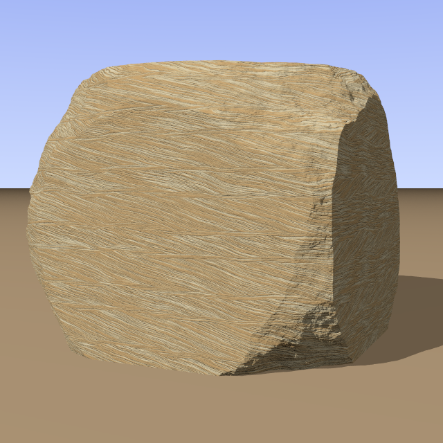
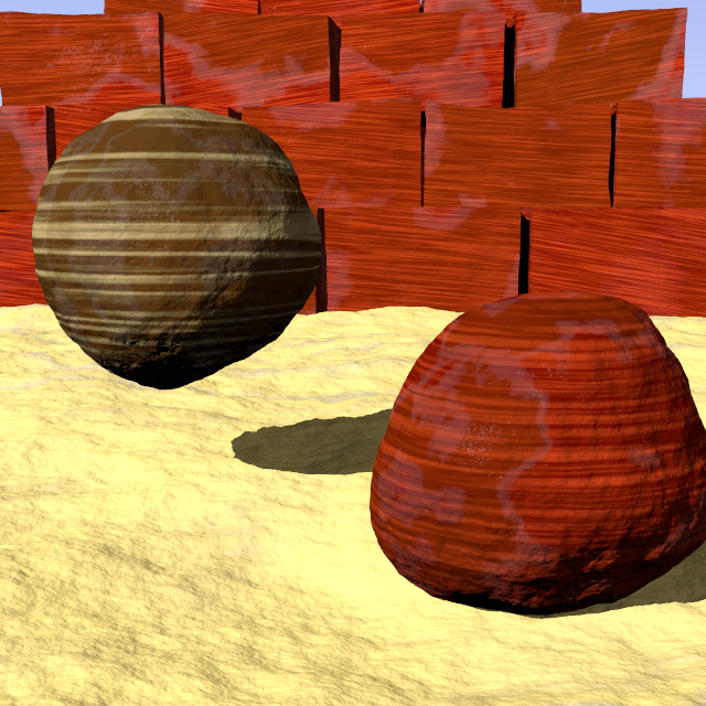
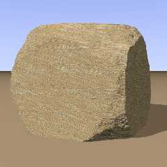
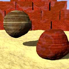
While digging through my archives I came across a couple of macros I
wrote back in 2006, inspired by textures devised by PM 2Ring (see:
https://news.povray.org/povray.binaries.images/thread/%3C4458a6b4%40news.povray.org%3E/),

and forgot about. I may need to revise them a bit but they render as the
attached images.

However, they are still available here:
https://news.povray.org/povray.binaries.scene-files/thread/%3C44649a96%40news.povray.org%3E/?ttop=441393&toff=500
https://news.povray.org/povray.binaries.scene-files/thread/%3C4461eb1f%40news.povray.org%3E/?ttop=441393&toff=500
https://news.povray.org/povray.binaries.scene-files/thread/%3C446841e1%40news.povray.org%3E/?ttop=441393&toff=500


> The links you posted are quite inspiring. The first image in the first link is
> something I've tried to do, but always seem to fail at. Later on that page, I
> was amazed to see that sand ripples could be captured in such a way.
>
Yes, amazing, isn't it? Those things are what have always attracted me
in sedimentary geology. And to realise that those same features can also
be found as far back as deep into the Precambrian, more than 4 billion
years ago, before even life took hold on this planet...

> Ultimately, nothing will beat a full 3d simulation using voxels or similar, but
> who's got the hardware for that? (Or the algorithms? ;P)
>
Good question...

> Btw, they mentioned Zion National Park. Did you ever get to go there? I was
> there when I was six, on a road trip my dad took us on when following a
> meandering path to Montana. Zion was my favorite out of all the places we
> visited. The reddish cliffs were pure eye candy. I was hoping to see some desert
> sandstone plateaus, but we never passed through any such areas :(
>
Alas, I never visited that iconic site. The cliffs are textbook examples
of a diversity of ancient environments. Something for another life! :-)

--
Thomas
Post a reply to this message
Attachments:
Download 'cross-bedded sandstone.png' (479 KB)
Download 'sandstone2.png' (626 KB)
Preview of image 'cross-bedded sandstone.png'
Preview of image 'sandstone2.png'
|
|
| |
| |
|
|
|
|
| |
| |
|
|
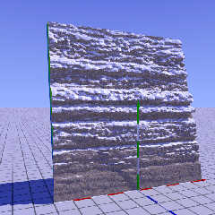
Here is just a subtle variation on the first experiment by transforming
the original height_field by a pair of matrix-shears (first y to z, then
z to y). (matrix-)shears might play an important role in this project, I
think.

--
Thomas
Post a reply to this message
Attachments:
Download 'hf_sedimentary_test_04.jpg' (177 KB)
Preview of image 'hf_sedimentary_test_04.jpg'
|
|
| |
| |
|
|
|
|
| |
| |
|
|
Thomas de Groot <tho### [at] degrootorg> wrote:
> Op 18/09/2023 om 15:04 schreef Thomas de Groot:
> > Note: Jaime Vives Piqueres is the author of hf2iso. I can recommend it
> > if you want to play with isosurface landscapes.
> >
>
> As an illustration of this, I include here an example rock face I
> rendered while testing, back in 2020.
>
> --
> Thomas

The image I just posted used hf2iso as well, but my rock faces are not as
realistic as yours!  I'll be interested in seeing more of your work on this, as
I'd like to find a good way to do interesting landscapes that don't take 10
weeks to render...

-- Chris R.
Post a reply to this message
|
|
| |
| |
|
|
|
|
| |
| |
|
|
Thomas de Groot <tho### [at] degrootorg> wrote:
> Op 23-9-2023 om 01:08 schreef Samuel B.:
> > Thomas de Groot <tho### [at] degrootorg> wrote:
> >> Following the discussion p.a-u on how to generate sediment layering
> >> without immediately requiring the use of isosurfaces [...]
> >
> > It looks very promising, Thomas! Any idea yet how you would go about
> > constructing an entire feature (e.g. cliffside in a landscape)?
> >
> Thanks Sam. It is very preliminary still. I have not yet thought about
> implementing this into a fully-fledged height_field/landscape, and
> possibly this is going to be difficult.
>
> While digging through my archives I came across a couple of macros I
> wrote back in 2006, inspired by textures devised by PM 2Ring [...]

Those are what you attached? The cross-bedded sandstone material looks very
good.

> > The links you posted are quite inspiring. The first image in the first link is
> > something I've tried to do, but always seem to fail at. Later on that page, I
> > was amazed to see that sand ripples could be captured in such a way.
> >
> Yes, amazing, isn't it? Those things are what have always attracted me
> in sedimentary geology. And to realise that those same features can also
> be found as far back as deep into the Precambrian, more than 4 billion
> years ago, before even life took hold on this planet...

Yeah... And to think, one could also find such things (and even
never-before-seen things) on different planets and moons. Differences in
gravity, atmospheric pressure, heat level and dissipation, primary erosive
liquids... these could all create geology quite a bit different than what we see
here on Earth.

Sam
Post a reply to this message
|
|
| |
| |
|
|
|
|
| |
| |
|
|
Op 25/09/2023 om 22:20 schreef Samuel B.:
> Thomas de Groot <tho### [at] degrootorg> wrote:
>> While digging through my archives I came across a couple of macros I
>> wrote back in 2006, inspired by textures devised by PM 2Ring [...]
>
> Those are what you attached? The cross-bedded sandstone material looks very
> good.
>
Yes they are indeed (i.e. attached, and very good) ;-)


>>> The links you posted are quite inspiring. The first image in the first link is
>>> something I've tried to do, but always seem to fail at. Later on that page, I
>>> was amazed to see that sand ripples could be captured in such a way.
>>>
>> Yes, amazing, isn't it? Those things are what have always attracted me
>> in sedimentary geology. And to realise that those same features can also
>> be found as far back as deep into the Precambrian, more than 4 billion
>> years ago, before even life took hold on this planet...
>
> Yeah... And to think, one could also find such things (and even
> never-before-seen things) on different planets and moons. Differences in
> gravity, atmospheric pressure, heat level and dissipation, primary erosive
> liquids... these could all create geology quite a bit different than what we see
> here on Earth.
>
Yes, I thought about that too. There are definitely (rippled) sand dunes
on Mars, very similar to Earth's despite a much thinner atmosphere. I am
not sure, but I seem to remember that the few photographs we got from
the surface of Titan in 2005 showed some tell-tale sedimentary
structures. At least there are wind-blown dunes and "river" systems in a
really alien landscape where water is replaced by hydrocarbons... And
indeed, we can already predict that any planet we discover outside the
Solar System (James Webb telescope) which has an atmosphere will also
show very similar sedimentary processes and structures on its surface in
accordance with its own particular chemistry.

--
Thomas
Post a reply to this message
|
|
| |
| |
|
|
|
|
| |
| |
|
|
Op 25-9-2023 om 16:46 schreef Chris R:
> The image I just posted used hf2iso as well, but my rock faces are not as
> realistic as yours!  I'll be interested in seeing more of your work on this, as
> I'd like to find a good way to do interesting landscapes that don't take 10
> weeks to render...
>
Yes, your render time is really extreme :-)

Something which can add interesting details to height_fields is using
sub-height_fields as proposed by Christian Froeschlin in... 2009. The
attached scene file shows how this works (I hope).

--
Thomas
Post a reply to this message
Attachments:
Download 'windows-1252' (11 KB)
Download 'wm_highmountainvalley_01b.png' (353 KB)
Preview of image 'wm_highmountainvalley_01b.png'

|
|
| |
| |
|
|
|
|
| |
| |
|
|
Il 24/09/2023 17:09, Thomas de Groot ha scritto:
> Here is just a subtle variation on the first experiment by transforming
> the original height_field by a pair of matrix-shears (first y to z, then
> z to y). (matrix-)shears might play an important role in this project, I
> think.
>
Both the images are very promising!

Paolo
Post a reply to this message
|
|
| |
| |
|
|
From: Thomas de Groot
Subject: Re: Heightfields of sediment layers - wip 1
Date: 5 Oct 2023 08:52:00
Message: <651eb170@news.povray.org>
|
|
|
| |
| |
|
|
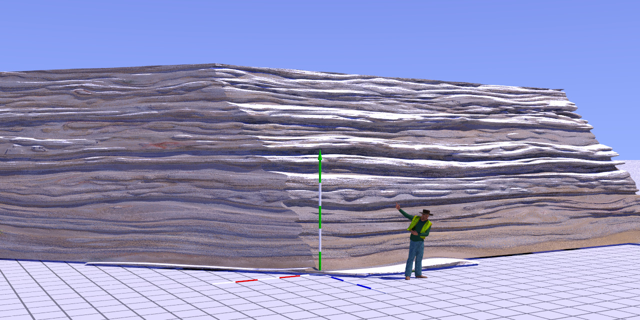
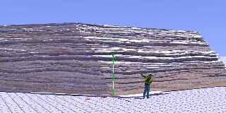
A first wip...

--
Thomas
Post a reply to this message
Attachments:
Download 'hf_sedimentary_test_06.jpg' (316 KB)
Preview of image 'hf_sedimentary_test_06.jpg'
|
|
| |
| |
|
|
|
|
| |
| |
|
|
Thomas de Groot <tho### [at] degrootorg> wrote:
> A first wip...
>
> --
> Thomas

Great, looking forwards to seeing this progress, I am intrigued to see what you
have planned.

Sean
Post a reply to this message
|
|
| |
| |
|
|
|
|
| |
| |
|
|
Thomas de Groot <tho### [at] degrootorg> wrote:
> A first wip...
>
> --
> Thomas

It's looking promising, Thomas.

Are you using an 8-bit gray scale map? I'm not sure if you're aware of this, but
Gimp now supports 16 bits per pixel, probably even more. You might have use a
..png image if you go that route, though.

Sam
Post a reply to this message
|
|
| |
| |
|
|
|
|
| |
| |
|
|
Il 05/10/2023 14:51, Thomas de Groot ha scritto:
> A first wip...
>

Mmm... A Great Train Robbery?

Paolo
Post a reply to this message
|
|
| |
| |
|
|
From: Thomas de Groot
Subject: Re: Heightfields of sediment layers - wip 1
Date: 6 Oct 2023 04:23:55
Message: <651fc41b@news.povray.org>
|
|
|
| |
| |
|
|
Op 5-10-2023 om 22:37 schreef Samuel B.:
> Thomas de Groot <tho### [at] degrootorg> wrote:
>> A first wip...
>>
>> --
>> Thomas
>
> It's looking promising, Thomas.
>
> Are you using an 8-bit gray scale map? I'm not sure if you're aware of this, but
> Gimp now supports 16 bits per pixel, probably even more. You might have use a
> ..png image if you go that route, though.
>
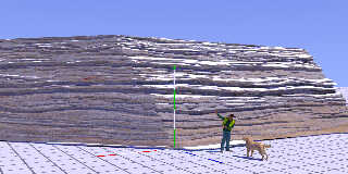
Ah! Thanks for reminding me, Sam. I was (un-)aware of this in my daily
use of Gimp as 8 bits are enough for most of my purposes, but here a
higher resolution might be asked for indeed. So, I first converted my
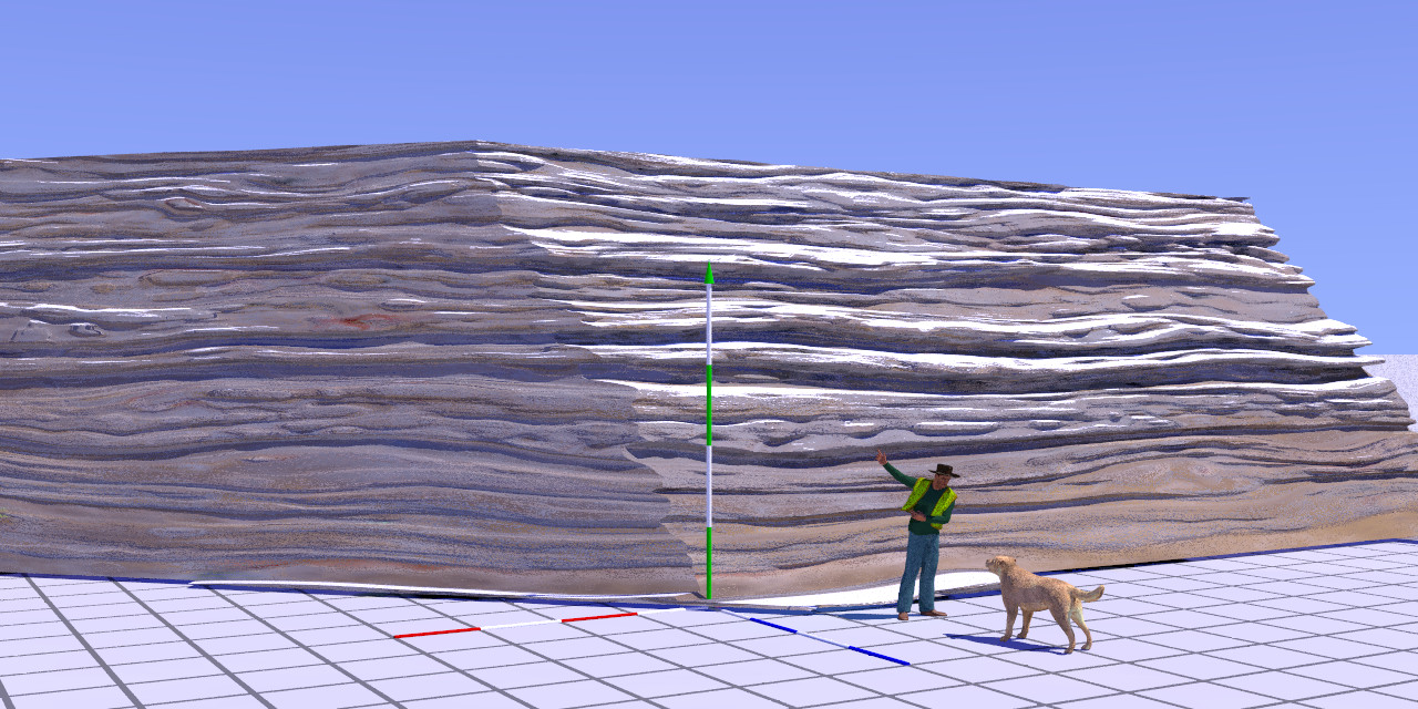
base (layered) sediment .xcf image to 32 bits, and exported to 16 bits
.png. The difference (see attached image) is not spectacular but still
noticeable in the small details.

I need to give an explanation (with code) about what I have been doing
up till now. I shall do that over the week-end.

In any case, this project has its serious limitations indeed as it
relies entirely on provided image maps and their (limited) manipulation
within POV-Ray by different (matrix) transformations while building the
height_field(s). I shall explain later...

--
Thomas
Post a reply to this message
Attachments:
Download 'hf_sedimentary_test_06c.jpg' (306 KB)
Preview of image 'hf_sedimentary_test_06c.jpg'
|
|
| |
| |
|
|
From: Thomas de Groot
Subject: Re: Heightfields of sediment layers - wip 1
Date: 6 Oct 2023 08:18:13
Message: <651ffb05@news.povray.org>
|
|
|
| |
| |
|
|
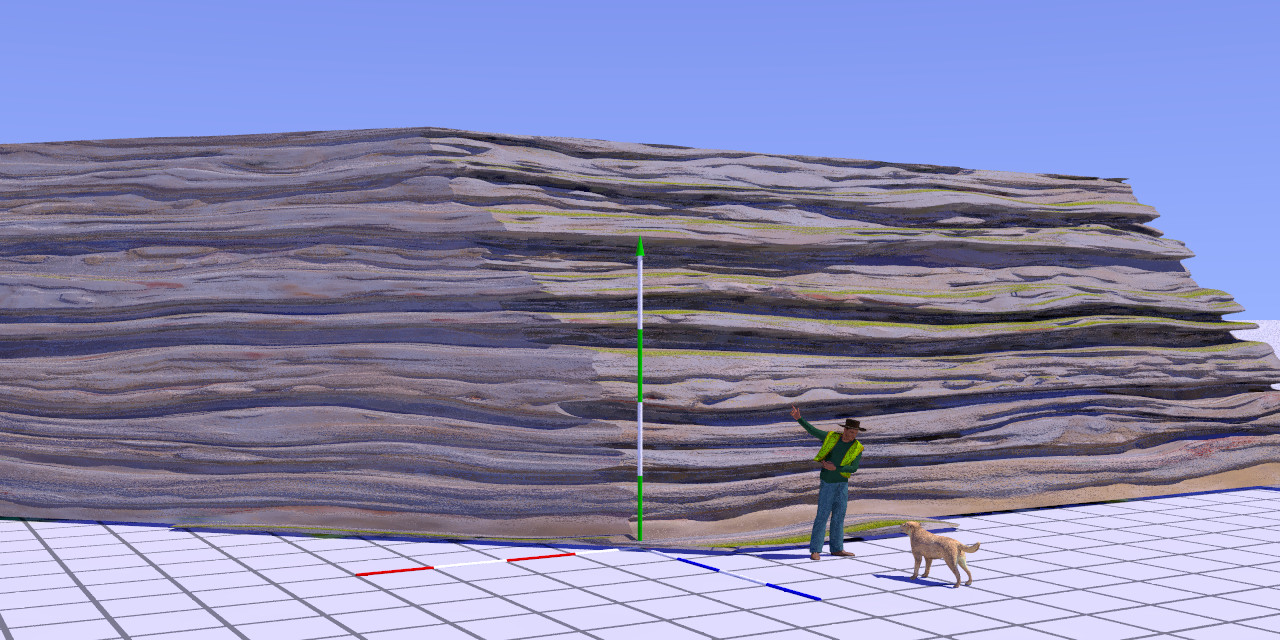
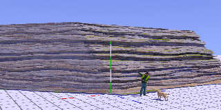
Just for testing, a version with more pronounced layer boundaries...
--
Thomas
Post a reply to this message
Attachments:
Download 'hf_sedimentary_test_06e.jpg' (295 KB)
Preview of image 'hf_sedimentary_test_06e.jpg'
|
|
| |
| |
|
|
|
|
| |
| |
|
|
Op 5-10-2023 om 23:36 schreef Paolo Gibellini:
> Il 05/10/2023 14:51, Thomas de Groot ha scritto:
>> A first wip...
>>
>
> Mmm... A Great Train Robbery?
>
> Paolo

I may be dim... can you explain? :-0

--
Thomas
Post a reply to this message
|
|
| |
| |
|
|
|
|
| |
| |
|
|
Thomas de Groot <tho### [at] degrootorg> wrote:
> Op 5-10-2023 om 22:37 schreef Samuel B.:
> > Thomas de Groot <tho### [at] degrootorg> wrote:
> >> A first wip...
> >>
> >> --
> >> Thomas
> >
> > It's looking promising, Thomas.
> >
> > [...]
> > Gimp now supports 16 bits per pixel, probably even more.
> >
> Ah! Thanks for reminding me, Sam. I was (un-)aware of this in my daily
> use of Gimp as 8 bits are enough for most of my purposes, but here a
> higher resolution might be asked for indeed. So, I first converted my
> base (layered) sediment .xcf image to 32 bits, and exported to 16 bits
> .png. The difference (see attached image) is not spectacular but still
> noticeable in the small details.

It looks a bit improved (or maybe just different), but I still see artifacts
characteristic of an 8-bit height map. The problem is that you can't add any
in-between elevations you didn't originally create... so, while the new image
might be a higher bit-depth, it will still contain the same stair-stepping
produced by the original 8-bits-per-channel image. (It might look slightly
different due to changes in the gamma level, or any up/down-scaling you might
have done, or something else, but the issue will remain.)

I can see two main options at this moment: 1) create a new height map starting
with an 16 bits per channel format, and painting everything again; or 2) convert
the map to 16 bit grayscale, upscale x2, blur slightly, and then downscale back
to the original x & y resolution using a good interpolation method. You will
lose some details with the second option. A third option might be to convert to
16-bit gray scale and then play with the blur and smudge tools, which would let
you put in some new details you might have wanted to add.

> I need to give an explanation (with code) about what I have been doing
> up till now. I shall do that over the week-end.
>
> In any case, this project has its serious limitations indeed as it
> relies entirely on provided image maps and their (limited) manipulation
> within POV-Ray by different (matrix) transformations while building the
> height_field(s). I shall explain later...
>
> --
> Thomas

I don't know exactly what your goals are, but can some things be done using
pigment maps and/or functions?

Sam
Post a reply to this message
|
|
| |
| |
|
|
From: Thomas de Groot
Subject: Re: Heightfields of sediment layers - wip 1
Date: 8 Oct 2023 04:10:20
Message: <652263ec@news.povray.org>
|
|
|
| |
| |
|
|
Op 7-10-2023 om 23:12 schreef Samuel B.:
> It looks a bit improved (or maybe just different), but I still see artifacts
> characteristic of an 8-bit height map. The problem is that you can't add any
> in-between elevations you didn't originally create... so, while the new image
> might be a higher bit-depth, it will still contain the same stair-stepping
> produced by the original 8-bits-per-channel image. (It might look slightly
> different due to changes in the gamma level, or any up/down-scaling you might
> have done, or something else, but the issue will remain.)
>
Right. I see what you mean (although I don't really see the "shaggies"
but you probably have a better screen, and better eyes, than I have ;-) ).

> I can see two main options at this moment: 1) create a new height map starting
> with an 16 bits per channel format, and painting everything again; or 2) convert
> the map to 16 bit grayscale, upscale x2, blur slightly, and then downscale back
> to the original x & y resolution using a good interpolation method. You will
> lose some details with the second option. A third option might be to convert to
> 16-bit gray scale and then play with the blur and smudge tools, which would let
> you put in some new details you might have wanted to add.
>
OK. I shall take this into account for future maps. I consider the
present one as a testing object.

> I don't know exactly what your goals are, but can some things be done using
> pigment maps and/or functions?
>
Basically, I use the image_map within a height_field function, more or
less warped, and then sheared using a matrix.

I attach in p.b.s-f a zip containing a simplified scene file + the
height_field image_map.

--
Thomas
Post a reply to this message
|
|
| |
| |
|
|
|
|
| |
| |
|
|
Thomas de Groot <tho### [at] degrootorg> wrote:
> Op 7-10-2023 om 23:12 schreef Samuel B.:
> > It looks a bit improved (or maybe just different), but I still see artifacts
> > characteristic of an 8-bit height map. The problem is that you can't add any
> > in-between elevations you didn't originally create... so, while the new image
> > might be a higher bit-depth, it will still contain the same stair-stepping
> > produced by the original 8-bits-per-channel image. [...]
> >
> Right. I see what you mean (although I don't really see the "shaggies"
> but you probably have a better screen, and better eyes, than I have ;-) ).

In the images you posted, I can't see individual height_field 'pixels,' but what
I do see is diffuse light being reflected only at certain angles, similar to a
'toon shader. It's a general lack of smoothness that the smooth keyword can't
touch... It's the same thing I've seen with free height maps found online.

> > I don't know exactly what your goals are, but can some things be done using
> > pigment maps and/or functions?
> >
> Basically, I use the image_map within a height_field function, more or
> less warped, and then sheared using a matrix.

Ah, ok. There are ways of ditching the matrix shears and doing everything
entirely with functions, but it would require somewhat extensive changes to the
code. And the result would not be the same :/

> I attach in p.b.s-f a zip containing a simplified scene file + the
> height_field image_map.
>
> --
> Thomas

I downloaded and rendered the scene. The result looks a lot smoother than the
images you posted... Did you use a dilate operation on the height_map? It seems
to have worked pretty well!

Sam

Btw, 'CamZoom' doesn't seem to do anything. Changing the camera's angle to this
makes it work: CamAng/CamZoom
Post a reply to this message
|
|
| |
| |
|
|
From: Thomas de Groot
Subject: Re: Heightfields of sediment layers - wip 1
Date: 9 Oct 2023 02:37:59
Message: <65239fc7@news.povray.org>
|
|
|
| |
| |
|
|
Op 08/10/2023 om 22:36 schreef Samuel B.:
> In the images you posted, I can't see individual height_field 'pixels,' but what
> I do see is diffuse light being reflected only at certain angles, similar to a
> 'toon shader. It's a general lack of smoothness that the smooth keyword can't
> touch... It's the same thing I've seen with free height maps found online.
>
I wonder if you do no interpret here the granite normals from the used
(complex) rock texture...? See below.

>>> I don't know exactly what your goals are, but can some things be done using
>>> pigment maps and/or functions?
>>>
>> Basically, I use the image_map within a height_field function, more or
>> less warped, and then sheared using a matrix.
>
> Ah, ok. There are ways of ditching the matrix shears and doing everything
> entirely with functions, but it would require somewhat extensive changes to the
> code. And the result would not be the same :/
>
Hmmm... I am not /that/ proficient with functions I am afraid, but it is
a way I certainly want to explore more in detail.

> I downloaded and rendered the scene. The result looks a lot smoother than the
> images you posted... Did you use a dilate operation on the height_map? It seems
> to have worked pretty well!
>
See above. As I did not change anything to the image_map, your comment
seems to partly confirm the 'normals' hypothesis... ;-)

[ex cathedra]
My playing with the warp {turbulence ...} had the interesting effect of
nicely simulating what is known as 'loading' in sedimentology:
alternating layers of unconsolidated, water-saturated, sediments
(sand/clay), for example in tidal basins with a high sediment input.
Differential compaction of those sediments may generate 'loading'
deformation of the coarser sediments into the finer ones. Earthquakes
can generate those same features by 'liquefying' soft sediments.
[/ex cathedra]

>
> Btw, 'CamZoom' doesn't seem to do anything. Changing the camera's angle to this
> makes it work: CamAng/CamZoom
>
I know. CamZoom is just there in case it is needed. It is in fact a
relict from another scene I didn't bother to ditch. :-)

--
Thomas
Post a reply to this message
|
|
| |
| |
|
|
|
|
| |
| |
|
|
Op 9-10-2023 om 08:37 schreef Thomas de Groot:
> Op 08/10/2023 om 22:36 schreef Samuel B.:
>> Btw, 'CamZoom' doesn't seem to do anything. Changing the camera's
>> angle to this
>> makes it work: CamAng/CamZoom
>>
> I know. CamZoom is just there in case it is needed. It is in fact a
> relict from another scene I didn't bother to ditch. :-)
>
Just for completeness sake, I checked; it originally came from the
original iso2pov scene codes by Jaime. I do not remember having checked
its correct working...

--
Thomas
Post a reply to this message
|
|
| |
| |
|
|
|
|
| |
| |
|
|
Thomas de Groot <tho### [at] degrootorg> wrote:
> Op 08/10/2023 om 22:36 schreef Samuel B.:
> > [...] It's a general lack of smoothness [...]
> >
> I wonder if you do no interpret here the granite normals from the used
> (complex) rock texture...? See below.

Yeah, it's quite possible. Also, other differences in shading, colors and aa
could have something to do with my perception of things.

> [ex cathedra]
> My playing with the warp {turbulence ...} had the interesting effect of
> nicely simulating what is known as 'loading' in sedimentology:
> alternating layers of unconsolidated, water-saturated, sediments
> (sand/clay), for example in tidal basins with a high sediment input.
> Differential compaction of those sediments may generate 'loading'
> deformation of the coarser sediments into the finer ones. Earthquakes
> can generate those same features by 'liquefying' soft sediments.
> [/ex cathedra]

It's very fascinating. I'm sure the layers could tell you a lot about the makeup
and history of the surrounding landscape... And I bet one could find heavier
minerals at the bottoms of various basins, given enough disturbance of the
sediments during and after deposition. Gold, if present, will of course settle
toward the bottoms of things, but other stuff is sure to settle in as well. Many
precious & semi-precious gems (ruby, garnet, etc.) are denser than other
minerals. In fact, there's a local creek where small red garnets can be found
alongside gold, provided the panning step isn't done too aggressively.

> > Btw, 'CamZoom' doesn't seem to do anything. Changing the camera's angle to this
> > makes it work: CamAng/CamZoom
> >
> I know. CamZoom is just there in case it is needed. It is in fact a
> relict from another scene I didn't bother to ditch. :-)
>
> [>] Just for completeness sake, I checked; it originally came from the
> original iso2pov scene codes by Jaime. I do not remember having checked
> its correct working...

Its funny how various bits of code tend to collect and deposit themselves in our
scenes over time :D

Sam
Post a reply to this message
|
|
| |
| |
|
|
|
|
| |
| |
|
|
Op 12/10/2023 om 00:40 schreef Samuel B.:
> Thomas de Groot <tho### [at] degrootorg> wrote:
>> Op 08/10/2023 om 22:36 schreef Samuel B.:
>>> [...] It's a general lack of smoothness [...]
>>>
>> I wonder if you do no interpret here the granite normals from the used
>> (complex) rock texture...? See below.
>
> Yeah, it's quite possible. Also, other differences in shading, colors and aa
> could have something to do with my perception of things.
>
...which still does not preclude your initial comment obviously. It is
something I have not been consciously aware of enough.

As a side track to the subject, I am playing also with height field maps
generated by GeoControl (*.tga). It also provides normal maps (the
well-known bluish maps) and greyscale maps, both as *.bpm. I want to
explore if I can usefully add the normal maps to my height fields. It
looks like it does.

>> [ex cathedra]
>> My playing with the warp {turbulence ...} had the interesting effect of
>> nicely simulating what is known as 'loading' in sedimentology:
>> alternating layers of unconsolidated, water-saturated, sediments
>> (sand/clay), for example in tidal basins with a high sediment input.
>> Differential compaction of those sediments may generate 'loading'
>> deformation of the coarser sediments into the finer ones. Earthquakes
>> can generate those same features by 'liquefying' soft sediments.
>> [/ex cathedra]
>
> It's very fascinating. I'm sure the layers could tell you a lot about the makeup
> and history of the surrounding landscape... And I bet one could find heavier
> minerals at the bottoms of various basins, given enough disturbance of the
> sediments during and after deposition. Gold, if present, will of course settle
> toward the bottoms of things, but other stuff is sure to settle in as well. Many
> precious & semi-precious gems (ruby, garnet, etc.) are denser than other
> minerals. In fact, there's a local creek where small red garnets can be found
> alongside gold, provided the panning step isn't done too aggressively.
>
Indeed. However, it all depends on the availability (far of or nearby)
of source rocks containing or having contained such minerals, as the
concentrations of gold or heavy minerals (placers!) are the results of
erosion and then winnowing by streams and other such processes. Even the
wind can play that role in desert environments. So yes, knowing
something about the local geology can be very useful.

>>> Btw, 'CamZoom' doesn't seem to do anything. Changing the camera's angle to this
>>> makes it work: CamAng/CamZoom
>>>
>> I know. CamZoom is just there in case it is needed. It is in fact a
>> relict from another scene I didn't bother to ditch. :-)
>>
>> [>] Just for completeness sake, I checked; it originally came from the
>> original iso2pov scene codes by Jaime. I do not remember having checked
>> its correct working...
>
> Its funny how various bits of code tend to collect and deposit themselves in our
> scenes over time :D
>
There it is! Erosion and sedimentation in action! :-)

--
Thomas
Post a reply to this message
|
|
| |
| |
|
|
|
|
| |
| |
|
|
Thomas de Groot <tho### [at] degrootorg> wrote:
> As a side track to the subject, I am playing also with height field maps
> generated by GeoControl (*.tga). It also provides normal maps (the
> well-known bluish maps) and greyscale maps, both as *.bpm. I want to
> explore if I can usefully add the normal maps to my height fields. It
> looks like it does.

What would the normal maps be useful for, I wonder? We can only change surface
normals via the normal{} block, so any other things for which we would use
normal maps can already be done with slope maps... There's functions I guess,
since I don't think we can use regular slope maps in those... so having a normal
map from another program might be useful there.

> >> [ex cathedra]
> >> My playing with the warp {turbulence ...} had the interesting effect of
> >> nicely simulating what is known as 'loading' in sedimentology [...]
> >
> > It's very fascinating. I'm sure the layers could tell you a lot about the makeup
> > and history of the surrounding landscape [...]
> >
> Indeed. However, it all depends on the availability (far of or nearby)
> of source rocks containing or having contained such minerals, as the
> concentrations of gold or heavy minerals (placers!) are the results of
> erosion and then winnowing by streams and other such processes. Even the
> wind can play that role in desert environments. So yes, knowing
> something about the local geology can be very useful.

Yeah, I think you could find out things about an area that are not otherwise
easily deduced by just studying the nearby bedrock. For instance (and I might've
mentioned this before), but around here there can be found a mineral called
sillimanite. Not only does it impart quartz with a neat opalaescent appearance,
but it can also be use as a gauge, indicating the specific range of temperatures
local minerals formed under at some point in the past. (And that's the extent of
my knowledge regarding the subject ;P)

Sam
Post a reply to this message
|
|
| |
| |
|
|
|
|
| |
| |
|
|
Op 14-10-2023 om 23:56 schreef Samuel B.:
> Thomas de Groot <tho### [at] degrootorg> wrote:
>> As a side track to the subject, I am playing also with height field maps
>> generated by GeoControl (*.tga). It also provides normal maps (the
>> well-known bluish maps) and greyscale maps, both as *.bpm. I want to
>> explore if I can usefully add the normal maps to my height fields. It
>> looks like it does.
>
> What would the normal maps be useful for, I wonder? We can only change surface
> normals via the normal{} block, so any other things for which we would use
> normal maps can already be done with slope maps... There's functions I guess,
> since I don't think we can use regular slope maps in those... so having a normal
> map from another program might be useful there.
>
I explored its use out of curiosity. I agree with you about their
usefulness: it is limited.

>>>> [ex cathedra]
>>>> My playing with the warp {turbulence ...} had the interesting effect of
>>>> nicely simulating what is known as 'loading' in sedimentology [...]
>>>
>>> It's very fascinating. I'm sure the layers could tell you a lot about the makeup
>>> and history of the surrounding landscape [...]
>>>
>> Indeed. However, it all depends on the availability (far of or nearby)
>> of source rocks containing or having contained such minerals, as the
>> concentrations of gold or heavy minerals (placers!) are the results of
>> erosion and then winnowing by streams and other such processes. Even the
>> wind can play that role in desert environments. So yes, knowing
>> something about the local geology can be very useful.
>
> Yeah, I think you could find out things about an area that are not otherwise
> easily deduced by just studying the nearby bedrock. For instance (and I might've
> mentioned this before), but around here there can be found a mineral called
> sillimanite. Not only does it impart quartz with a neat opalaescent appearance,
> but it can also be use as a gauge, indicating the specific range of temperatures
> local minerals formed under at some point in the past. (And that's the extent of
> my knowledge regarding the subject ;P)
>
Sillimanite... reminds me of mineral microscopy in my student's years,
especially because it was so easy to recognise at first sight! :-)

--
Thomas
Post a reply to this message
|
|
| |
| |
|
|
|
|
| |
| |
|
|
On 06/10/2023 14:46, Thomas de Groot wrote:
> I may be dim... can you explain?

The scene reminds me of those in western movies or comics where bandits
are planning a big train robbery.
The grazing light places a lot of emphasis on the sedimentary rock, and
it seems as if the cowboy is telling others to climb it to observe from
above.

Paolo
Post a reply to this message
|
|
| |
| |
|
|
|
|
| |
| |
|
|
Op 17/10/2023 om 00:28 schreef Paolo Gibellini:
> On 06/10/2023 14:46, Thomas de Groot wrote:
>> I may be dim... can you explain?
>
> The scene reminds me of those in western movies or comics where bandits
> are planning a big train robbery.
> The grazing light places a lot of emphasis on the sedimentary rock, and
> it seems as if the cowboy is telling others to climb it to observe from
> above.
>
Lol! You are perfectly right indeed! I was too much focussed on the
doggy being trained to climb rocks. :-)

--
Thomas
Post a reply to this message
|
|
| |
| |
|
|
|
|
| |
|
|