|
 |
Hi(gh)!
While staying with an also POV-Ray-enthusiastic friend over the weekend,
I solved the problem of the inaccuracy-related gaps between the mesh2
triangles:
#declare
lNormVect=vnormalize(<sin(radians(-Cam_Long))*cos(radians(Cam_Lat)),
sin(radians(Cam_Lat)),
cos(radians(-Cam_Long))*cos(radians(Cam_Lat))>);
with Cam_Long and Cam_Lat being the geographical coordinates of the
camera position (Earth's center is currently located at the origin,
which will change later on, then of course I'll have to subtract its
position from the camera position vector!);
#declare ApproxLook = vnormalize(lNormVect) * rd;
The normalized camera coordinate vector is multiplied with Earth's
radius (oops, I just notice that I unnecessarily normalized it once more)...
...during the creation of the mesh2, from each vertex ApproxLook is
subtracted, so that it ends up close to the origin and thus inaccuracies
are minimized. Afterwards, the mesh2 object is translated back by the
amount of ApproxLook.
This solution is in fact the one Mike Williams taught me about ten years
ago... but I did not implement it correctly until now.
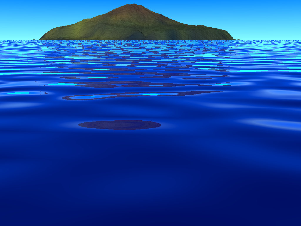
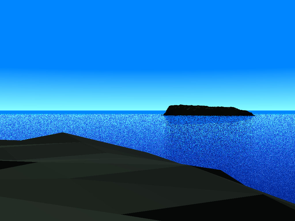
I'm now also able to use satellite mosaic tiles from the Blue Marble
Next Generation series; their resolution is considerably lower than the
elevation data (240 x 240 pixels per square degree as compared to 3601 x
3601 elevation points), but one the other hand, they are readily
color-processed (as compared to raw Landsat images) and come in 12
versions for each month of the year 2004, so I can show the terrain in
different seasons - my current views of Tristan da Cunha use the January
version, which result in a southern summer view.
But as my computer has got "only" 16 GiB of RAM, I had to reduce the
resolution of the used elevation data from the original 3601 to 2600
data points per degree... full resolution would only work at 32 GiB, if
I want to render views of continental areas, especially from higher
camera altitudes, which would contain several data tiles, I should go
for at least 128 GiB, which also means buying a more advanced mainboard
and processor, as my current one can handle only 32 GiB...
(I remember that about twelve years ago, I roughly calculated - then
totally utopian - 8 GiB of RAM as being sufficient for rendering entire
Afghanistan...)
Next step would be adding a more realistic sky also providing sunlight
refraction effects at low illumination angles... I probably will use
Bruno Cabasson's atmosphere model rather than Christoph Hormann's, as I
used the former already with my "Ghurghusht" renderings of 2010.
And I will render more "showcase" views for the POVEarth project: the
Kabul area with the Paghman mountains, the Shomali plain and the
mountains around Salang pass (which would be a part of Khyberspace
proper); the gulf of Tunis; the Georgian Caucasus with the Kolkhetian plain.
Attached here ere some new views of the Tristan da Cunha group...
See you in Khyberspace!
Yagar
Post a reply to this message
Attachments:
Download '2013-07-08 tristan da cunha from west, take 4 (2600x2600).jpg' (139 KB)
Download '2013-07-08 inaccessible from nightingale, take 2 (2600x2600).jpg' (182 KB)
Preview of image '2013-07-08 tristan da cunha from west, take 4 (2600x2600).jpg'
Preview of image '2013-07-08 inaccessible from nightingale, take 2 (2600x2600).jpg'
|
|