|
 |
Hi(gh)!
After a longer retreat from active POVing (and, instead, collecting
elevation data for my POVEarth project), I started to generate
heightfields from ASTER GeoTIFFs (3601 x 3601 data points per degree)
and, subsequently, curved mesh2s (following the curvature of Earth's
surface) from these heightfields.
But whatever I try, all I get is an empty black scene... I tried
tweaking the distance of the sun (Earth's center is at the origin), the
illumination direction, correctly applying rotations of mesh2, camera
position and camera direction, but no effect at all.
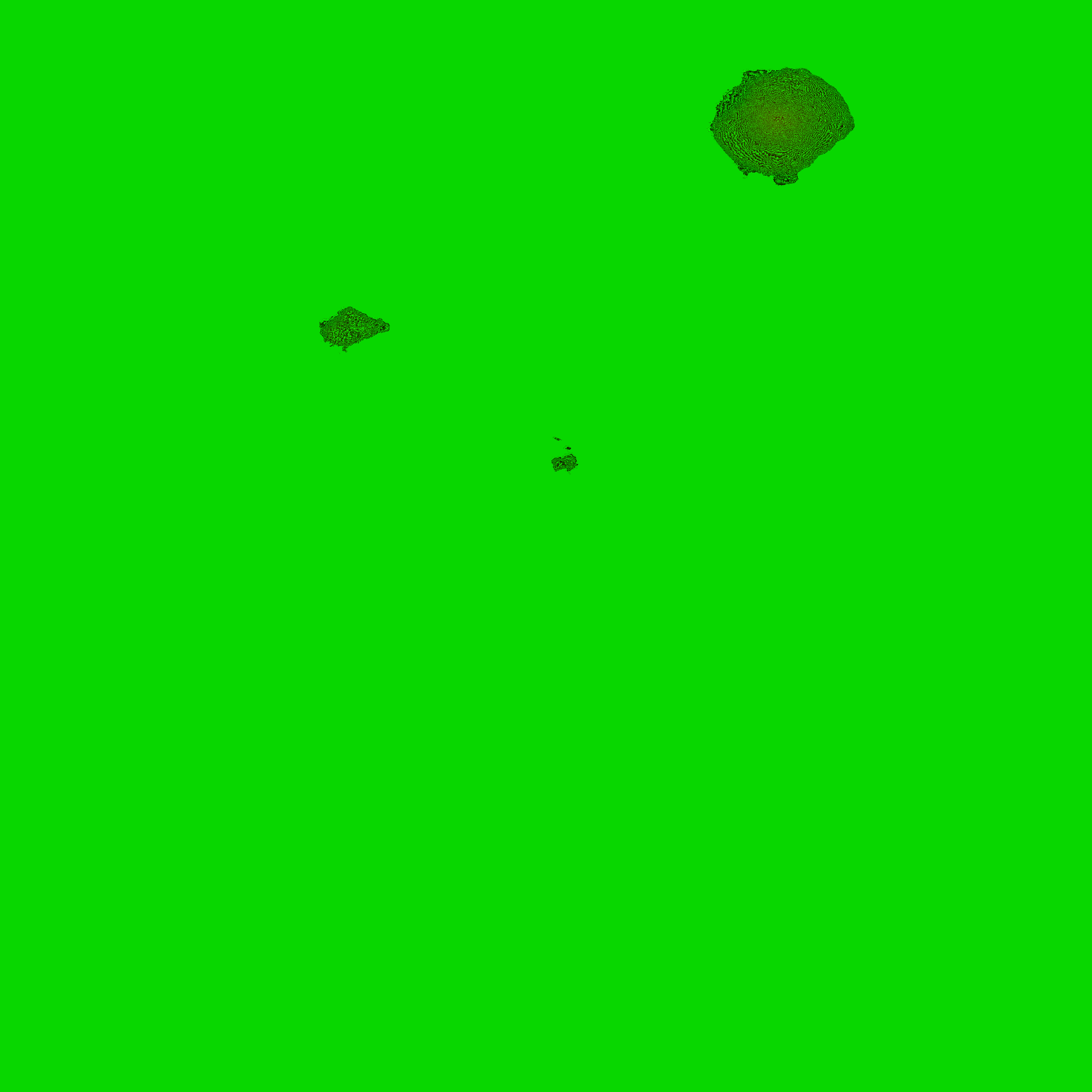
The scene should show a bird's view of the Tristan da Cunha archipelago
in the southern Atlantic Ocean from about 10000 metres (currently only
the bare relief with a simple green texture, no ocean or realistic
satellite mosaic texture yet)...
Here is the code:
// Begin of code
#include "functions.inc"
#declare sf=0.001; // scaling factor to avoid epsilon problems
#declare os=0; // 0: Linux, 1: Windows
#switch (os)
#case (0)
#declare path="";
#break
#case (1)
#declare path="../SRTM/png_patched/";
#break
#end
global_settings
{
assumed_gamma 2
}
#declare xdim=3601;
#declare ydim=3601;
#declare deadsea=422;
#declare everest=8848;
#declare rng=deadsea+everest;
#declare rd=6378140;
#declare latstart=-37; // meshes are calculated from
#declare longstart=-13; // the northwestern to southeastern corner of
the original DEM tile
#declare res=3601;
#declare map=
pigment
{
image_map
{
png concat(path, "s38w013_corrected.png")
}
}
#declare Cam_Azi=-89.99999;
#declare Cam_Dir=0;
#declare Cam_Lat=-37.5;
#declare Cam_Long=-12.5;
#declare Cam_Height=10000;
#declare Earth_Pos=0;
#declare Earth_Tilt=0; // 23.439281;
#declare Earth_Rot=0;
#declare Earth_Slice=
mesh2
{
vertex_vectors
{
xdim*ydim
#declare row=0;
#while (row<ydim)
#declare col=0;
#while (col<xdim)
#declare clrvect=eval_pigment(map, <1/(xdim*2)+col/xdim,
1-(1/(ydim*2)+row/ydim), 1>);
#declare hval=clrvect.red*256+clrvect.green;
#declare hval=-deadsea+rng/65535*hval;
rd+hval*<sin(radians(-longstart-col/xdim))*cos(radians(latstart-row/ydim)),
sin(radians(latstart-row/ydim)),
cos(radians(-longstart-col/xdim))*cos(radians(latstart-row/ydim))>*sf
#if (!(row=ydim-1 & col=xdim-1)) // no comma after last vector
,
#end
#declare col=col+1;
#end
#declare row=row+1;
#end
}
face_indices
{
(xdim-1)*(ydim-1)*2
#declare r=0;
#while (r<ydim-1)
#declare c=0;
#while (c<xdim-1)
<r*xdim+c, r*xdim+c+1, (r+1)*xdim+c>,
<r*xdim+c+1, (r+1)*xdim+c+1, (r+1)*xdim+c>
#if (!(r=ydim-2 & c=xdim-2)) // no comma after last vector
,
#end
#declare c=c+1;
#end
#declare r=r+1;
#end
}
texture
{
pigment { color rgb <0, 0.8, 0> }
finish { ambient 0.1 diffuse 1 brilliance 0.4 }
}
double_illuminate
}
#declare Cam_surfpos=trace(Earth_Slice, Earth_Pos,
2*rd*<sin(radians(-Cam_Long))*cos(radians(Cam_Lat)),
sin(radians(Cam_Lat)), cos(radians(-Cam_Long))*cos(radians(Cam_Lat))>);
#declare Cam_Pos=Cam_surfpos+vnormalize(Cam_surfpos)*Cam_Height;
#declare Cam_Pos=vrotate(Cam_Pos, <0, Earth_Rot, 0>);
#declare Cam_Pos=vrotate(Cam_Pos, <Earth_Tilt, 0, 0>);
#declare Cam_Look=<sin(radians(Cam_Dir))*cos(radians(Cam_Azi)),
sin(radians(Cam_Azi)), cos(radians(Cam_Dir))*cos(radians(Cam_Azi))>;
#declare Cam_Look=vrotate(Cam_Look, <90-Cam_Lat, -Cam_Long, 0>);
#declare Cam_Look=vrotate(Cam_Look, <0, Earth_Rot, 0>);
#declare Cam_Look=vrotate(Cam_Look, <Earth_Tilt, 0, 0>);
#declare Cam_Look=Cam_Pos+Cam_Look;
#declare Cam_Sky=<0, 1, 0>;
#declare Cam_Sky=vrotate(Cam_Sky, <90-Cam_Lat, -Cam_Long, 0>);
#declare Cam_Sky=vrotate(Cam_Sky, <0, Earth_Rot, 0>);
#declare Cam_Sky=vrotate(Cam_Sky, <Earth_Tilt, 0, 0>);
object
{
Earth_Slice
rotate <Earth_Tilt, 0, 0>
rotate <0, Earth_Rot, 0>
}
/* sphere
{
0, rd
texture
{
pigment { color rgb <0, 0, 0.4> }
finish { ambient 0.1 diffuse 1 brilliance 0.6 }
}
} */
camera
{
location Cam_Pos*sf
look_at Cam_Look*sf
sky Cam_Sky
angle 40
}
/* camera
{
location <20000000, -20000000, 20000000>*sf
look_at 0
angle 60
} */
light_source
{
<149600000000, 0, 0>*sf*sf
color rgb 1
}
// end of code
I also attached the heightfield generated from the original ASTER
GeoTIFF tile.
...and I thought I could come up with a surprise rendering of Tristan da
Cunha as an introduction to POVEarth... but, alas, I'm no Christoph
Hormann, so probably the whole thing is several orders of magnitude too
ambitious for me. I should content myself with pixeling nice little flat
heightfields and placing a few trees and buildings on them...
See you in Khyberspace!
Yadgar
Post a reply to this message
Attachments:
Download 's38w013_corrected.png' (253 KB)
Preview of image 's38w013_corrected.png'

|
|