|
 |
High!
Smws wrote:
> I have been lurking on these newsgroups for a little while now, and since I have
> been raytracing again I thought I would post something.
>
> I've been working with pseudorandom landscape generation --seemingly a phase
> many people go through :) and here is one of the more interesting landscapes
> that I have come across so far. Sorry for the very boring texture, no other
> objects, etc.
>
> function pattern dents - function pattern granite
Interesting... as I myself started tinkering with a whole isosurface
planet, I would like to know how you combined the two functions, i. e.
what amount and scale for each!
My isosurface landscape (see below) currently is a combination of
x*x + y*y + z*z -1 for overall spherical shape of the planet,
granite, scaled to 10 and using a poly_wave with exponent 0.3333 for the
mountain ridges, finally
bozo for large-scale variance of elevation
The amount (multiplication factor within the combined isosurface) of
granite is 0.02, of bozo is 0.01.
Here my code:
#declare Terrain_Part1_Function=
function
{
pattern
{
granite
scale 10
poly_wave 0.333
}
}
#declare Terrain_Part2_Function=
function
{
pattern
{
bozo
}
}
#declare S =
function { x*x + y*y + z*z -1 }
#declare Ghurghusht =
union
{
isosurface
{
function { S(x, y, z) + Terrain_Part1_Function (x*50, y*50,
z*50)*0.02 + Terrain_Part2_Function (x, y, z)*0.01 } // f_noise3d
(x*100, y*100, z*100)*0.007 }
contained_by { sphere { 0, 1 } }
max_gradient 10
accuracy 0.0001
texture
{
pigment { color rgb <0.98, 0.85, 0.45> }
finish { ambient 0.05 diffuse 1 brilliance 0.98 }
}
}
scale 5178 // radius in kilometres
}
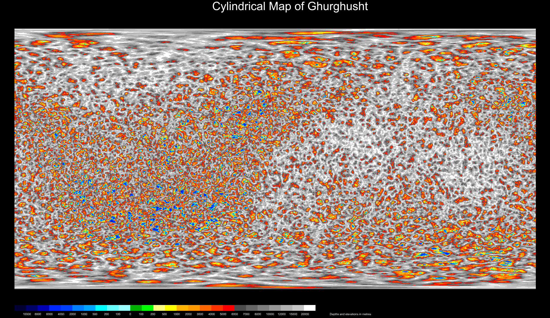
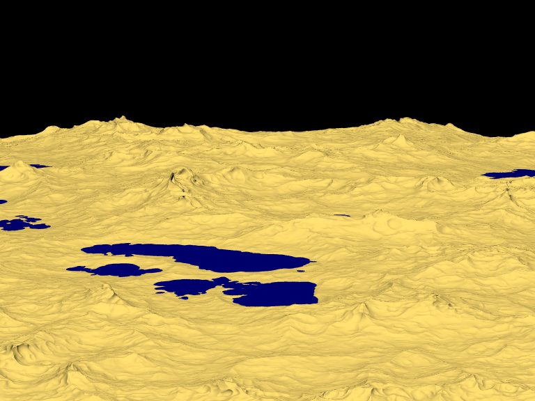
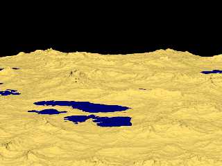
Currently, I have not yet rendered a close-up surface view in
"pedestrian" perspective (only a close-up of the planet's limb at the
equator, see last image)... but I think I'll replace that simple granite
function later on by ridged_mf or a similar more sophicisticated
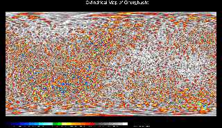
function to get wider lowlands at 0 to 200 metres elevation around the
lakes (see cylindrical map). Then there is also the problem of modelling
realistic erosion/drainage patterns...
See you in Khyberspace!
Yadgar
Post a reply to this message
Attachments:
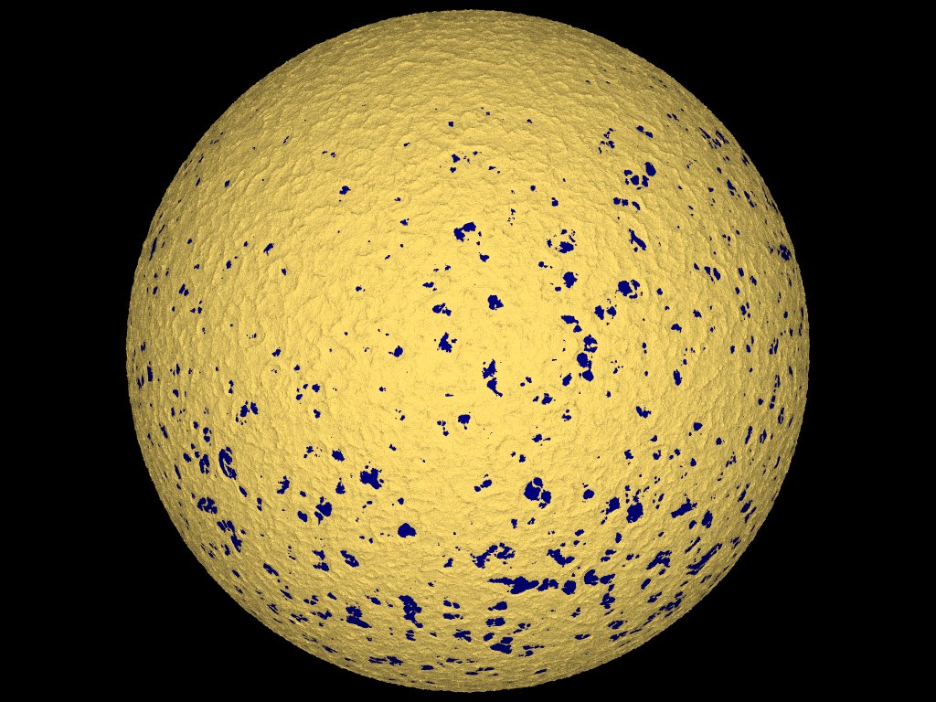
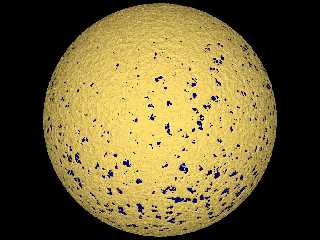
Download '2010-01-24 ghurghusht, lakes hemisphere, take 1.jpg' (180 KB)
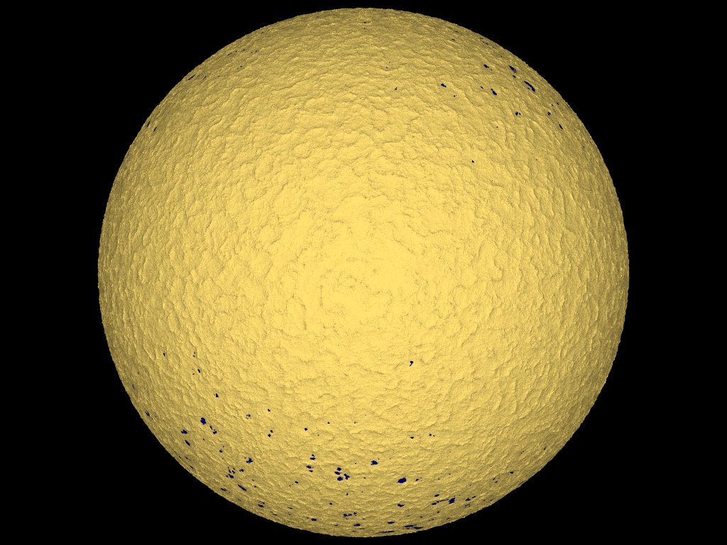
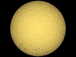
Download '2010-01-26 ghurghusht, highland hemisphere, take 1.jpg' (146 KB)
Download '2010-02-05 cylindrical map of ghurghusht, take 3.png' (935 KB)
Download 'ghurghusht0186.png' (348 KB)
Preview of image '2010-01-24 ghurghusht, lakes hemisphere, take 1.jpg'
Preview of image '2010-01-26 ghurghusht, highland hemisphere, take 1.jpg'
Preview of image '2010-02-05 cylindrical map of ghurghusht, take 3.png'
Preview of image 'ghurghusht0186.png'
|
|