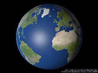
At the first glance this probably looks like yet another boring earth
image but it is somewhat different.
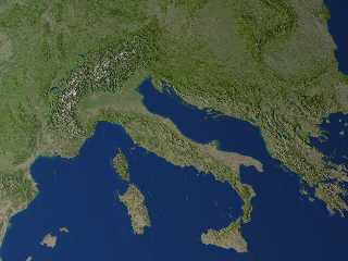
I used the 1km resolution data sets for geometry and coloring available
on:
http://earthobservatory.nasa.gov/Newsroom/BlueMarble/
and used real surface geometry instead of bump mapping. Of course the
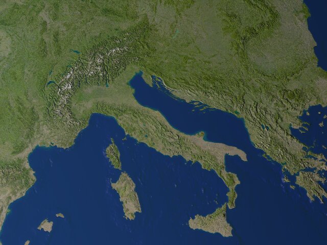
detail is hardly visible at this size, the second image shows a sample
from the original render at 6400x4800 pixel size.
It was of course not possible to render the whole planet in one piece, the
height data alone is about 2GB. Therefore i split it into 45x45 degree
tiles and rendered them one after the other (with some overlap).
Files with cloud coverage data are available at the mentioned site too but
with strongly varying quality. A short distance view with clouds of parts
of europe (with 2.5x exaggerated height) can be seen on:
http://www.schunter.etc.tu-bs.de/~chris/files/earth_a2.jpg
the same without clouds on:
http://www.schunter.etc.tu-bs.de/~chris/files/earth_a1.jpg
I searched a lot for cloud height data which would be important for
realistic clouds but i could not find anything useful.
I also made a view with natural height scale of western himalayas and
karakorum:
http://www.schunter.etc.tu-bs.de/~chris/files/earth_a3l.jpg
this shows the available detail level in the data and also the varying
quality in some parts (note the broad band of lower quality on the right).
Christoph
--
POV-Ray tutorials, include files, Sim-POV,
HCR-Edit and more: http://www.tu-bs.de/~y0013390/
Last updated 28 Feb. 2003 _____./\/^>_*_<^\/\.______
Post a reply to this message
Attachments:
Download 'earth_l.jpg' (71 KB)
Download 'earth_l_detail.jpg' (68 KB)
Preview of image 'earth_l.jpg'
Preview of image 'earth_l_detail.jpg'
|