|
|
|
|
|
|
| |
| |
|
|
|
|
| |
| |
|
|
High!
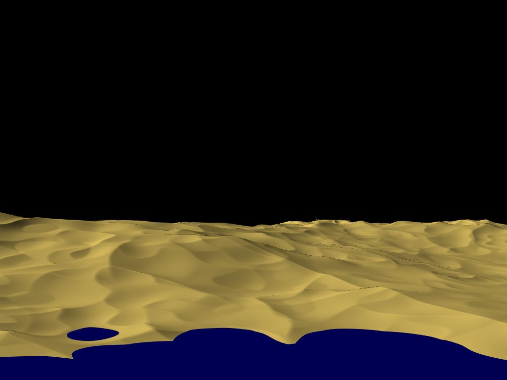
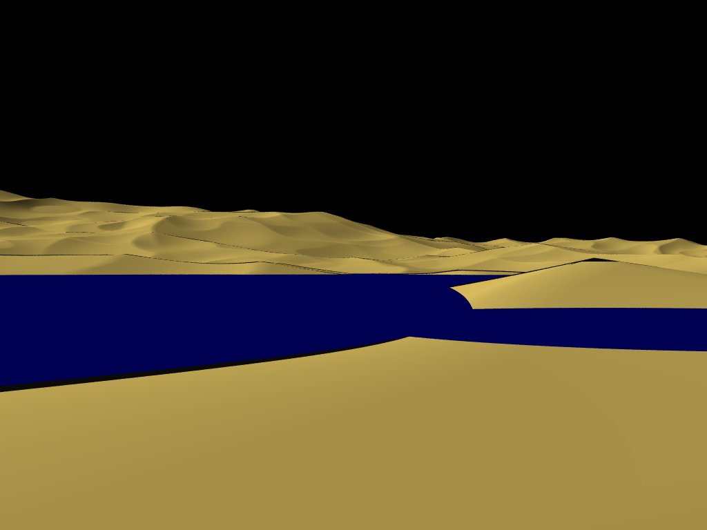
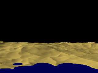
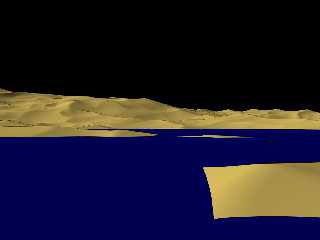
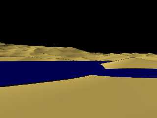
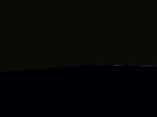
Meanwhile, I managed to get surface views from my isosurface desert
planet ("Ghurghusht")... the four pictures attached here show the same
landscape from 17,000, 1,000, 200 and 80 metres above ground - with the
last one, I got the render warning "Camera is inside a non-hollow object".
Ghurghusht has a radius of about 5117 units and is placed 570,000 units
from the origin... could it be that trace() is that inaccurate? Is there
any way to get rid of it?
See you in Khyberspace!
Yadgar
Post a reply to this message
Attachments:
Download '2010-02-22 ghurghusht, northern shore of glatzer lacus from 17 kms altitude,take 1.jpg' (37 KB)
Download '2010-02-22 ghurghusht, glatzer lacus from 1 km altitude, take 1.jpg' (29 KB)
Download '2010-02-22 ghurghusht, glatzer lacus from 200 metres altitude above jawandinsula, take 1.jpg' (28 KB)
Download '2010-02-22 ghurghusht, glatzer lacus from 80 metres altitude above jawandinsula, take 1.jpg' (7 KB)
Preview of image '2010-02-22 ghurghusht, northern shore of glatzer lacus from 17 kms altitude,take 1.jpg'
Preview of image '2010-02-22 ghurghusht, glatzer lacus from 1 km altitude, take 1.jpg'
Preview of image '2010-02-22 ghurghusht, glatzer lacus from 200 metres altitude above jawandinsula, take 1.jpg'
Preview of image '2010-02-22 ghurghusht, glatzer lacus from 80 metres altitude above jawandinsula, take 1.jpg'
|
|
| |
| |
|
|
|
|
| |
| |
|
|
High!
I forgot to add that 1 POV unit equals 1 kilometre!
See you in Khyberspace!
Yadgar
Post a reply to this message
|
|
| |
| |
|
|
|
|
| |
| |
|
|
> High!
>
> Meanwhile, I managed to get surface views from my isosurface desert
> planet ("Ghurghusht")... the four pictures attached here show the same
> landscape from 17,000, 1,000, 200 and 80 metres above ground - with the
> last one, I got the render warning "Camera is inside a non-hollow object".
>
> Ghurghusht has a radius of about 5117 units and is placed 570,000 units
> from the origin... could it be that trace() is that inaccurate? Is there
> any way to get rid of it?
>
> See you in Khyberspace!
>
> Yadgar
>
Are you tracing against the actual surface, or the water's surface?
For the last image, you may be between the water and the ground. Try to
make your water transparent and hollow and see what it gives.
Alain
Post a reply to this message
|
|
| |
| |
|
|
|
|
| |
| |
|
|
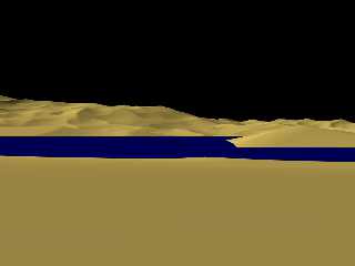
Alain wrote:
> Are you tracing against the actual surface, or the water's surface?
>
> For the last image, you may be between the water and the ground. Try to
> make your water transparent and hollow and see what it gives.
I tried that, but it didn't work... but then, I separated the original
union of isosurface and "water sphere" and traced just against the
isosurface - and then it worked! Nevertheless, thank you for your hint
(and be prepared to find your name one day in some of my other planetary
systems)!
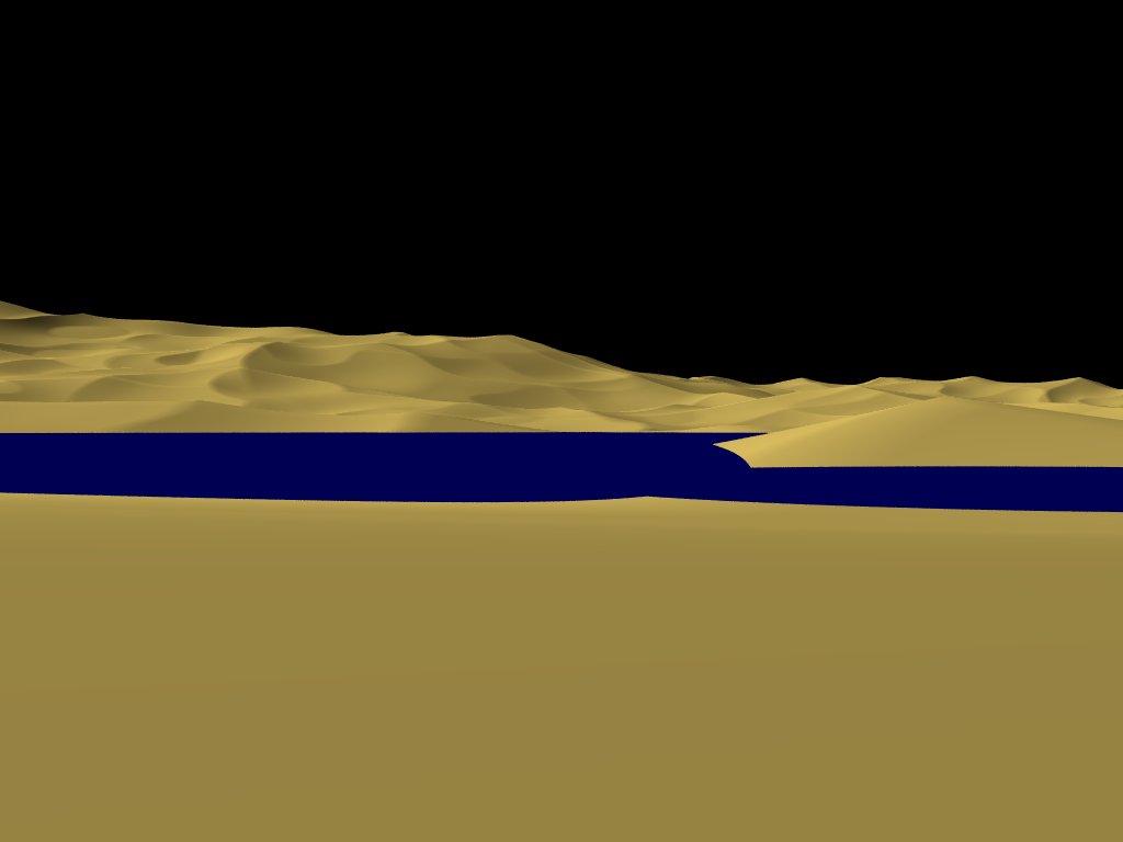
Then I also applied double_illuminate to get rid of the strange
shadows... below is the result: Lake Glatzer as seen from Jawand Island
at "pedestrian perspective", i. e. 1.7 metres above ground, looking
approximately northward (five degrees to the east)...
And now the next, probably much more difficult problem: currently I only
use a granite pattern for the terrain isosurface (plus some large-scale
bozo for global height variation), so it generally looks like smooth
sand dunes or loess hills - which would be perfect if I intended to
model the whole planet after some parts of northern Afghanistan, but I'd
rather go for more rugged mountains, as in fact they tower up to 30
kilometres (!) high in many parts.
I think applying some small-scale noise could do the trick - but how can
I restrict that noise to medium and high altitudes only while leaving
the lower parts smooth?
See you in Khyberspace!
Yadgar
Now playing: Anne Boleyn "The Day thou gavest Lord hath ended" (Rick
Wakeman)
Post a reply to this message
Attachments:
Download '2010-02-22 ghurghusht, glatzer lacus from jawand insula, pedestrian view,take 1.jpg' (24 KB)
Preview of image '2010-02-22 ghurghusht, glatzer lacus from jawand insula, pedestrian view,take 1.jpg'
|
|
| |
| |
|
|
|
|
| |
|
|