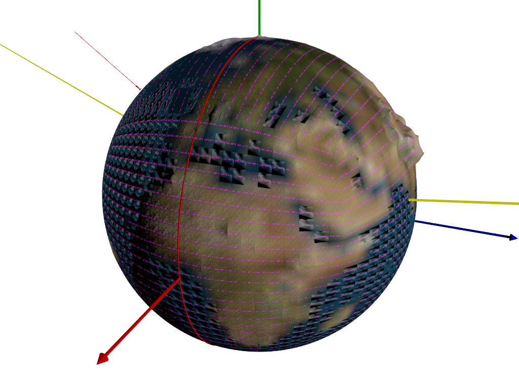
OK, got my image map oriented, and have a Prime Meridian indicator.
I have a macro for determining what tile includes a given point, so the proper
file(s) can be edited.
Got rid of relative filenames.
Need to tweak the implementation a bit, using the ini and shell command stuff.
I have uv_mapped tile numbers, and I fixed the Bezier array so that it uv maps
the correct way.
(was thinking maybe checkerboarding the tilename colors and/or orientation +/-
45 deg)
Added prefixes Planet_ and User_ to tile filenames on either side so that they
are easily differentiable without knowing the path (like looking at the filename
in an editor) ;)
Moved the tile generator and the tile index file into the PlanetCode directory
so that they're not mixed in with the tiles.
Reworked my bilinear interpolation macro into a function, and used that to
create a function pigment in order to take the pigment at each of the 4 corners
of a tile and interpolate the rest of the tile.
Added normals, and finishes with some control variables.
Parse - 7 seconds
Render - 11 seconds.
24 x 24 tiles per face = 576 * 6 faces = 3456 tiles.
Post a reply to this message
Attachments:
Download 'myplanet.png' (535 KB)
Preview of image 'myplanet.png'
|