|
 |
Hi(gh)!
On 26.02.20 03:31, Dick Balaska wrote:
> How about using Qt C++ regular expressions to read the data and then
> write it out as something rigid for your SDL to interpret?
>
> Regular expressions are pretty flexible when dealing with floating point
> numbers. For example, I parse this whole file from my cave scene. It
> lays out the points of the plants and paths of the fish.
>
http://git.buckosoft.com/gitweb/pov.cgi?p=tteoac.git;a=blob;f=ttvo/ocean/forester.inc
>
>
> This is the file that reads and writes that data.
> http://git.buckosoft.com/gitweb/pov.cgi?p=forester.git;a=blob;f=filehandler.cpp
>
>
> I would be willing to help you get that going, if you'd like.
> I'd hate to see your dreams die. Plus, I want to see POVghanistan. :)
Meanwhile, I have to soften my harsh initial stance... I finally found a
way to get those ASCII data tiles POV-readable, albeit at a slight
expense of accuracy. Very most of the elevation values are in fact
integers, written pro forma as floats, they end with .00 (or, rarely,
.0). A tiny fraction of them contains digits different from zero after
the decimal point, so I decided to truncate them all to integers by
using this bash script:
swcorner=$1
sed 's/.[0-9][0-9] /,/g' $swcorner".txt" > $swcorner"_pov.txt"
sed 's/ //g' $swcorner"_pov.txt" > $swcorner".txt"
sed 's/,,/,/g' $swcorner".txt" > $swcorner"_pov.txt"
mv -f $swcorner"_pov.txt" $swcorner".txt"
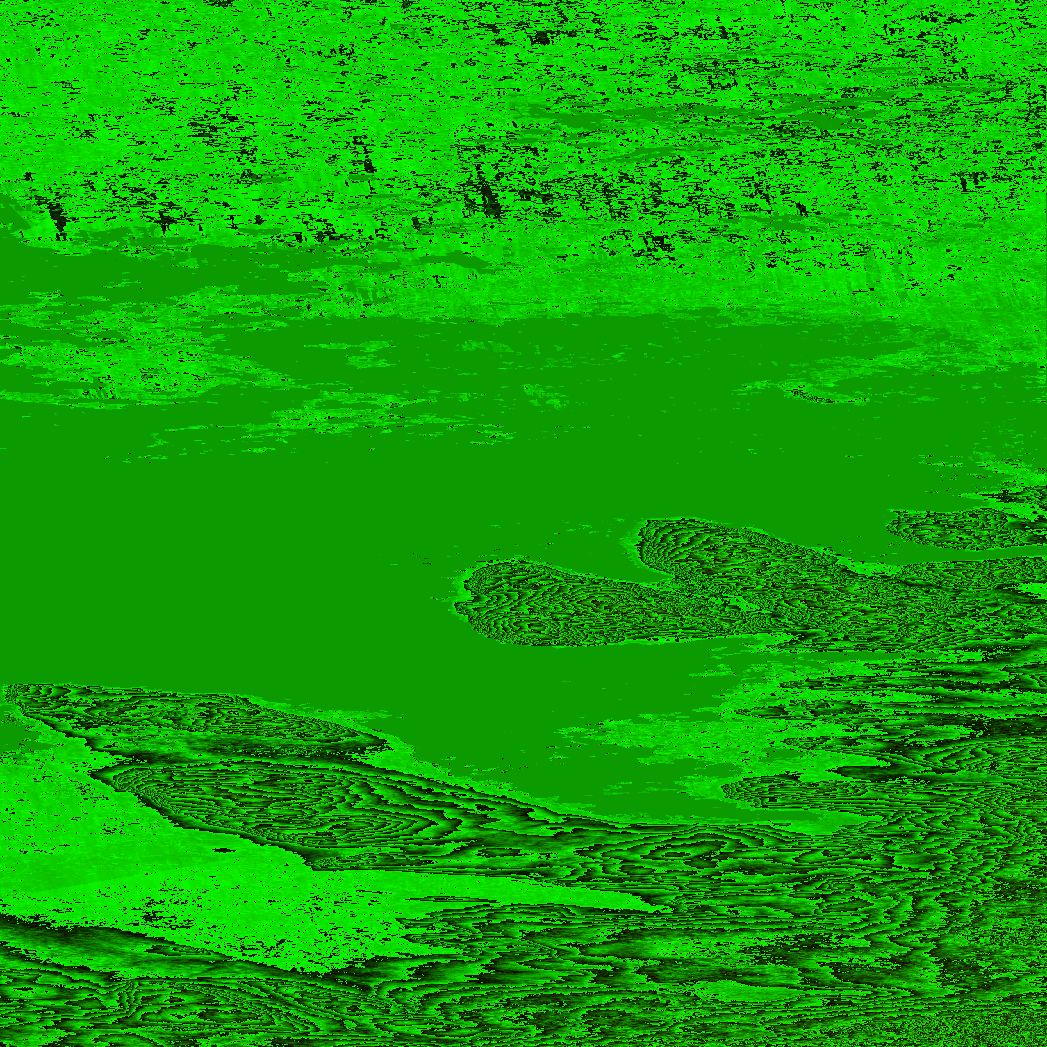
This way, I generated about ten heightfields of the Arctic Norwegian
archipelago of Svalbard, also known as Spitsbergen, all along the 80th
parallel (one attached here)... my next task will be cleaning up these
heightfields manually, as the ASTER Earth surveyor mission's radar was
not able to tell land from sea ice. I will model sea as a plain "basin"
about 100 meters deep, no actual bathymetry (at least for the time
being), at least deep enough to be intransparently dark when I once more
borrow Christoph Hormann's water like I did earlier in this decade.
Another issue will be finding texture tiles in cylindrical projection to
apply them to the terrain slices to be generated from the heightfields -
currently, I only have access the famous cloud-free "Blue Marble"
mosaic, 86400 by 43200 pixels for the whole Earth equaling 240 x 240
pixels per square degree - but as my elevation data tiles contain 3600 x
3600 (plus one in north and east direction for seamless aligning)
measuring points, I would like to find something at a higher resolution.
I know that LANDSAT tiles at 1200 x 1200 per square degree exist (or at
least have existed in the early 2010s). But recently, I could not get
access to single tiles... does anyone here know more?
An advantage of "Blue Marble" tiles, however, is that they are available
for each month of 2004, so that advancing and shrinking snow cover as
well as die-off and re-greening of vegetation can be included into
POVEarth (at least as basic soil texture as long as there are not real
snow or vegetation objects placed on the terrain relief)...
See you in Khyberspace!
Yadgar
Post a reply to this message
Attachments:
Download 'n80e019.png' (4557 KB)
Preview of image 'n80e019.png'

|
|