Hi(gh)!
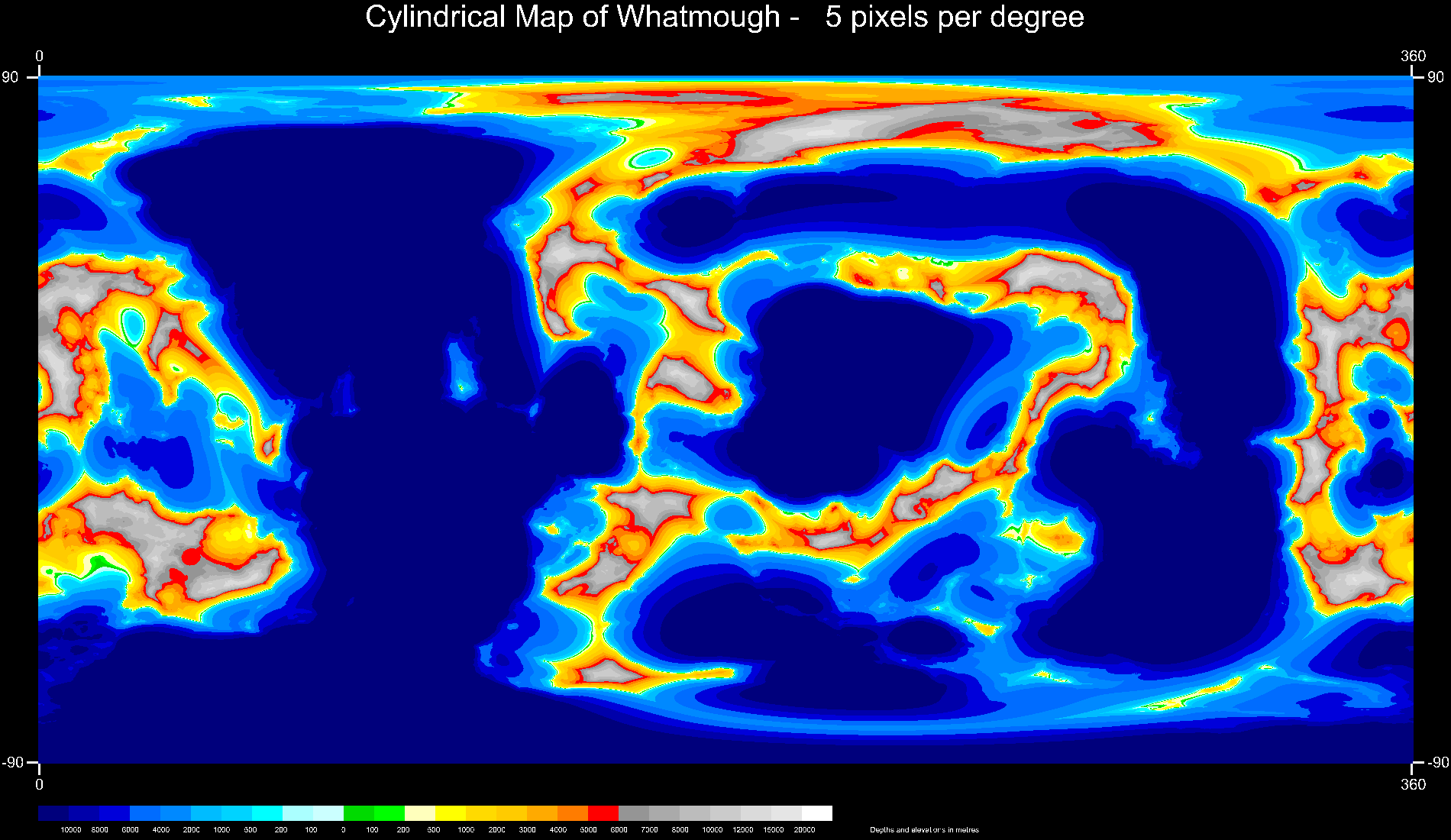
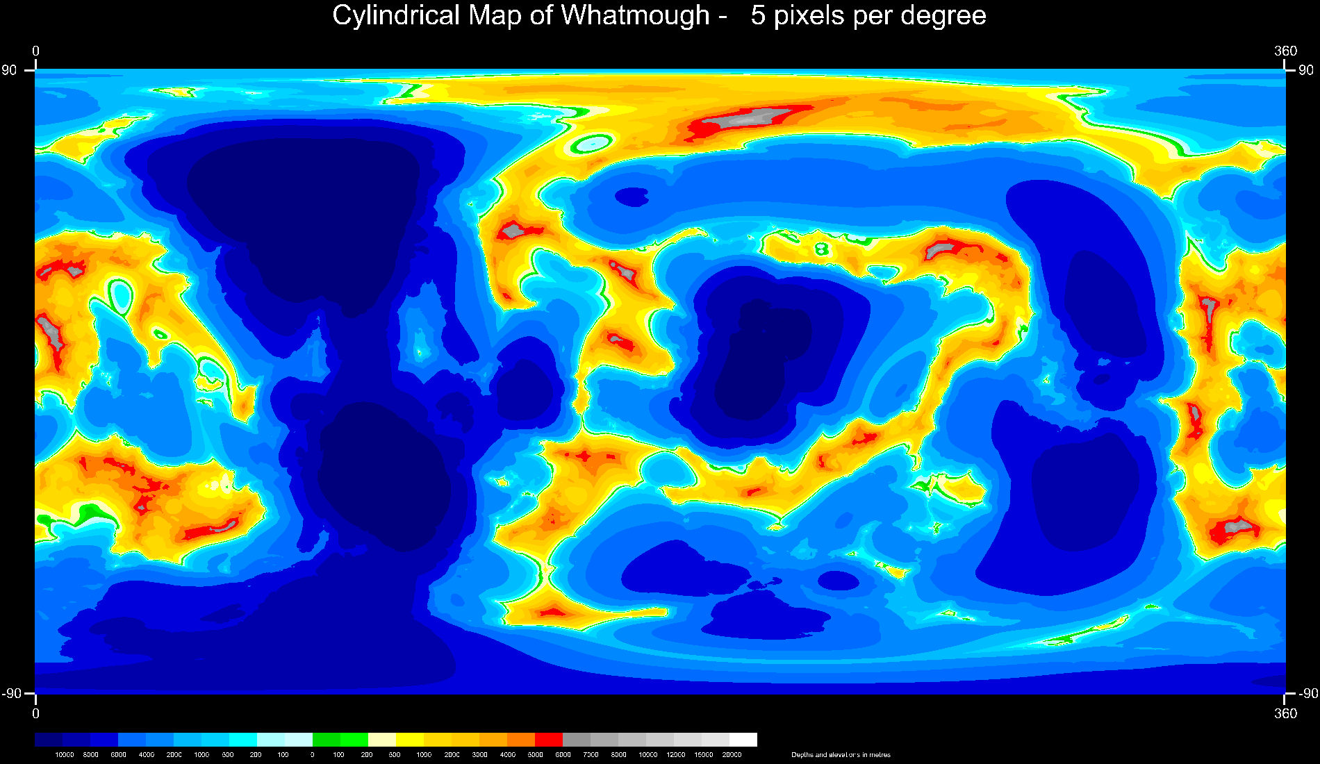
Meanwhile, I generated the first global physical maps of Whatmough (see
also my posting in p.b.a), starting with the terrain relief and land/see
distribution as shown in the animation (first image attached)... as
ocean depths and land heights were still too extreme for an almost
Earth-sized body, I tweaked the scaling factor of the terrain function
as well as the sea level (second image). But still I'm not contented
with the result, as low-lying land areas (dark and light green) and
shallow continental shelves (pale cyan) are by far too narrow to look
Earth-like. Which parameter(s) of the ridged_mf() function do I have to
change to achieve this?
See you in Khyberspace!
Yadgar
Post a reply to this message
Attachments:
Download '2018-02-12 global map of whatmough, take 1.png' (188 KB)
Download '2018-02-13 global map of whatmough, take 4.png' (159 KB)
Preview of image '2018-02-12 global map of whatmough, take 1.png'
Preview of image '2018-02-13 global map of whatmough, take 4.png'

|