|
 |
Hi(gh)!
On 04.12.2014 09:09, Thomas de Groot wrote:
> On 3-12-2014 23:40, eticre wrote:
>> Thanks!
>> now I relax for 2000 or 3000 years, clouds and stars are my greatest
>> difficulty.
>> I'm also looking for an approach via isosurface instead of normal
>> using ridged
>> multifractal for terrain elevation, this is my best result
>
> Isosurfaces is an excellent alternative to height_fields indeed although
> slower to render. I have not yet tried it for planets as I first wanted
> the textures to be right, but ridged multifractals at the core would be
> essential. I did a lot of experimentations with isosurface landscapes in
> the past and would need to reactivate my memory (and my documentation) a
> bit :-)
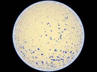
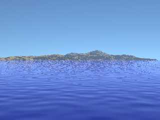
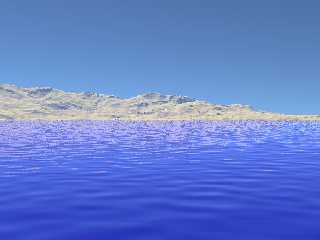
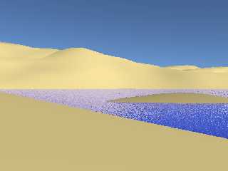
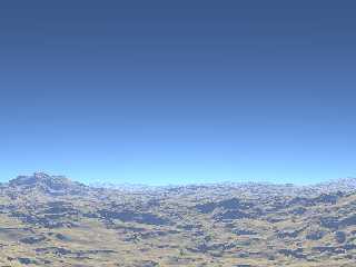
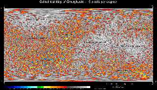
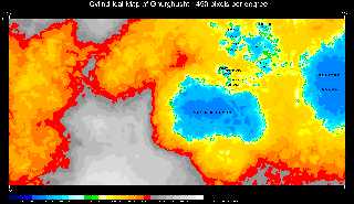
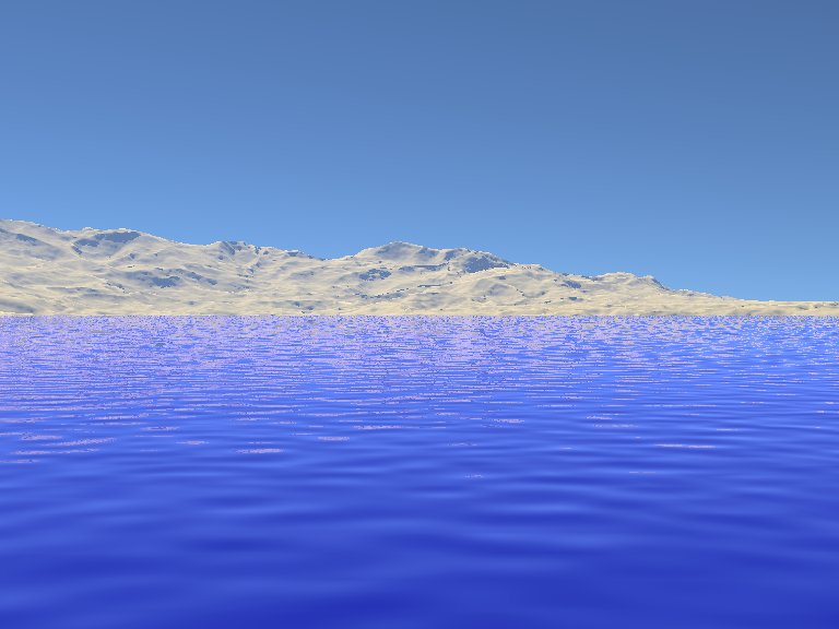
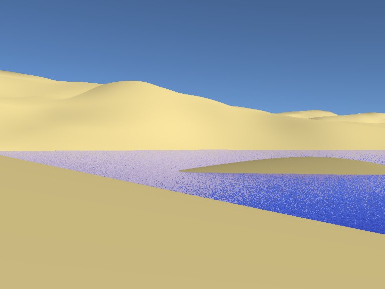
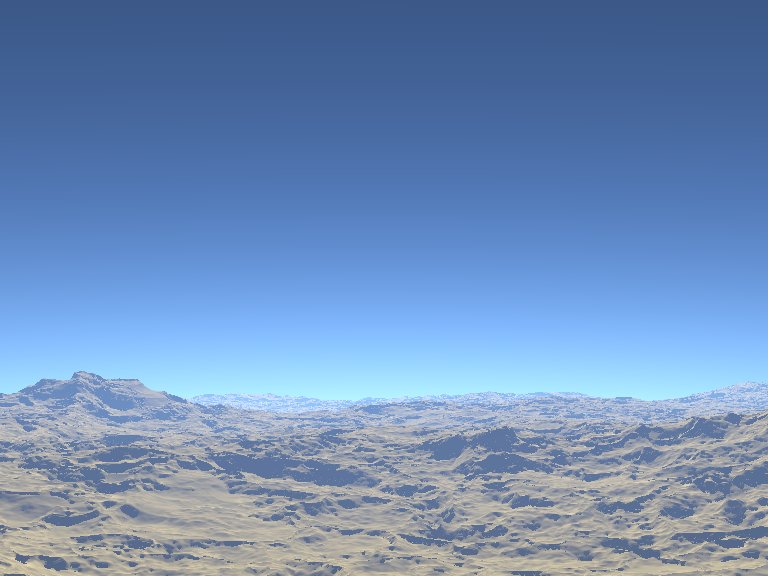
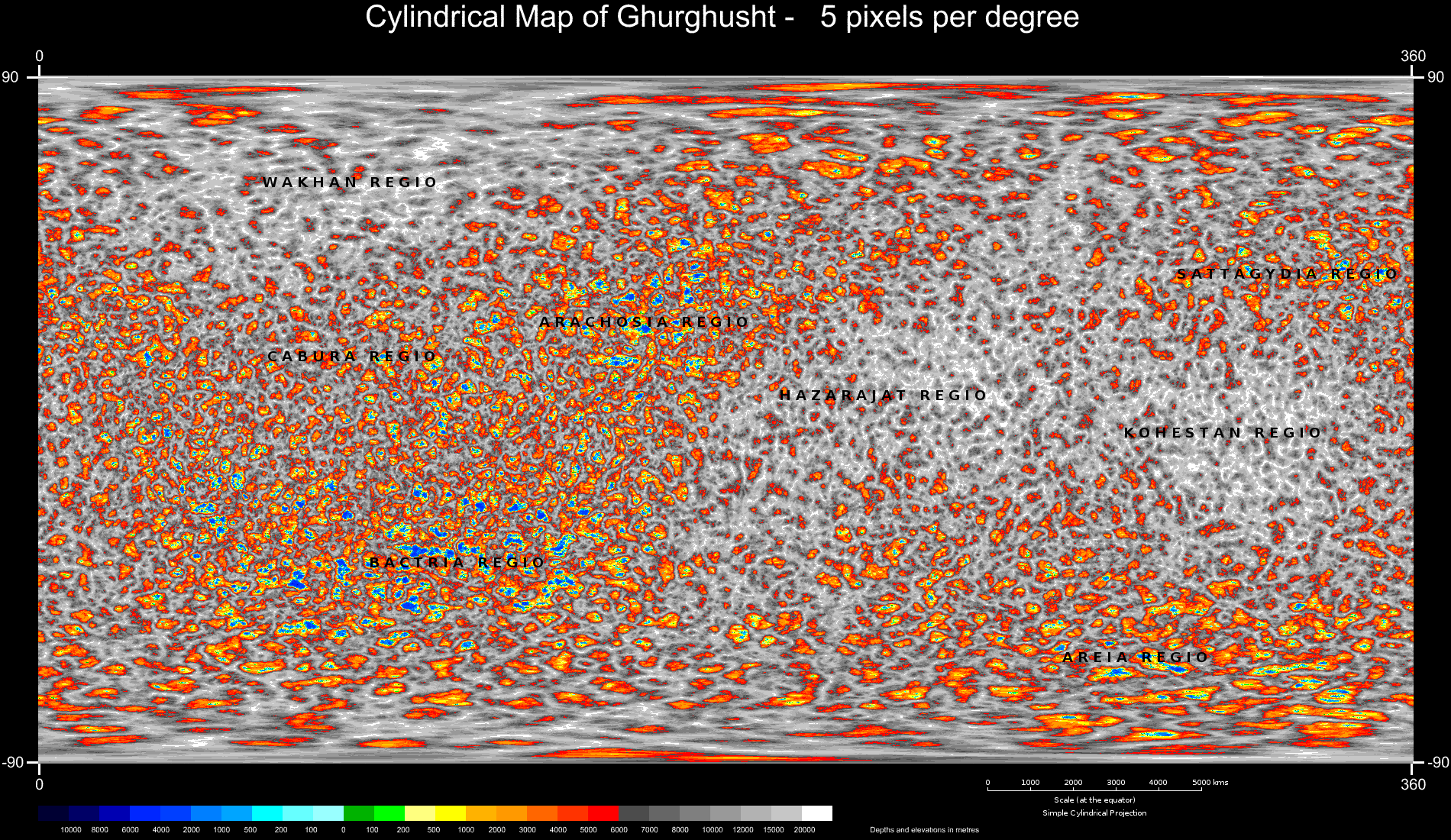
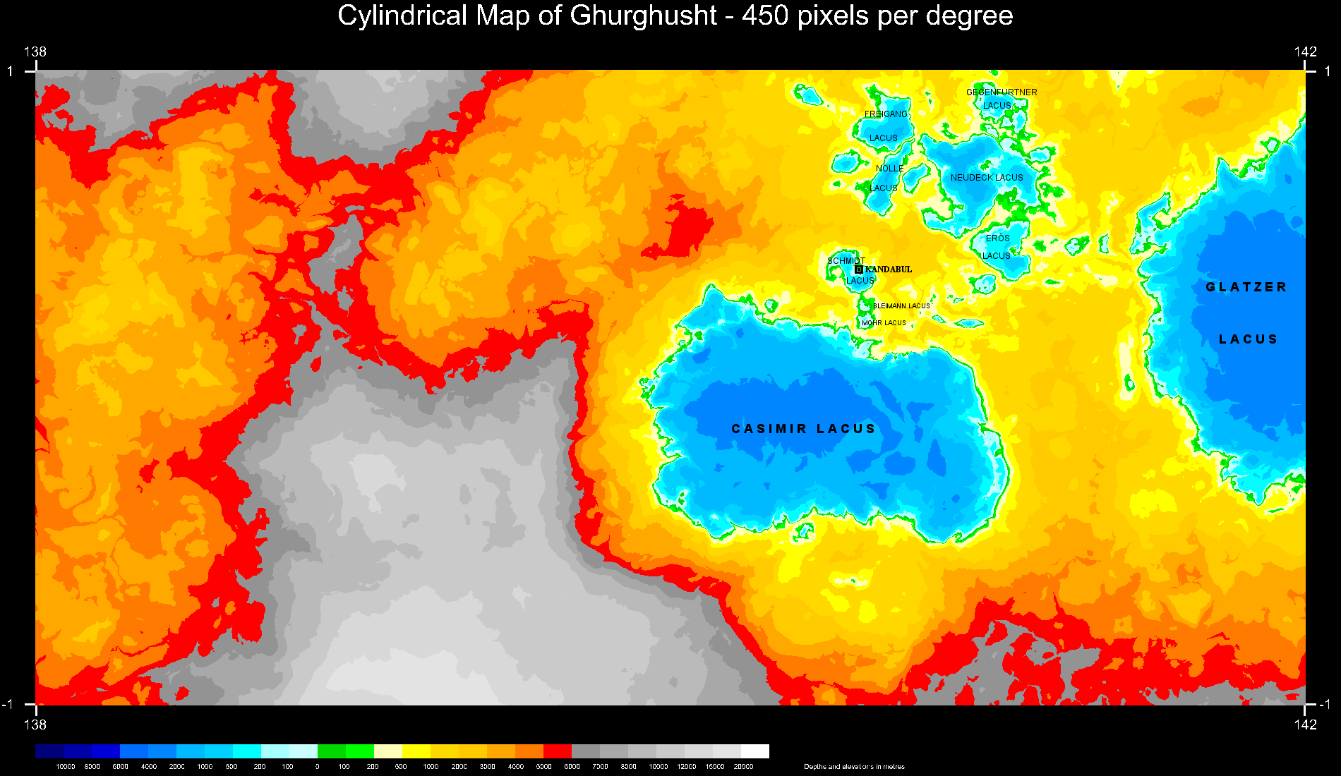
Back in 2010 (as some around here might remember) I rendered a whole
planet ("Ghurghusht"), technically a somewhat Earth-like moon of a gas
giant ("Qais") based on a combination of various isosurface patterns, at
a resolution high enough to get semi-realistic landscapes even from the
viewpoint of a pedestrian standing on the surface, and using Bruno
Cabasson's atmosphere tool. Some views attached here:
1. an entire hemisphere of Ghurghusht
2. a "pedestrian view" of Rathjens Lacus on Ghurghusht
3. a "pedestrian view" of Centlivres Lacus on Ghurghusht
4. a "pedestrian view" of Schmidt Lacus with Sitara Insula (planned
location of Kandabul City)
5. an overflight view of a region at Ghurghusht's equator from about 35
kms height
6. a global physical map of Ghurghusht
7. a physical map of Schmidt Lacus region
and, finally, a link to an animation showing an entire day at Schmidt
Lacus: https://www.youtube.com/watch?v=qyN0zwTW0xU
See you in Khyberspace!
Yadgar
Post a reply to this message
Attachments:
Download '2010-05-05 ghurghusht, global view centered on substellar point, take 5 (thickness 100, density 0.15, rayleigh factor 0.' (110 KB)
Download '2010-05-05 ghurghusht, rathjens lacus from 1.7 metres, looking east, take 6 (thickness 150, density 0.15, rayleigh facto' (46 KB)
Download '2010-05-05 ghurghusht, centlivres lacus from 1.7 metres, looking north, take 5.jpg' (55 KB)
Download '2010-05-15 ghurghusht, achakzai peninsula and sitara insula from 1.7 m, take 1.jpg' (37 KB)
Download '2010-05-23 ghurghusht, start point for ghurghust equatorial flight from 35,000 metres, looking east, take 1.jpg' (59 KB)
Download '2010-04-01 cylindrical map of ghurghusht, 5 pixels per degree, labelled.png' (1029 KB)
Download '2010-05-15 ghurghusht, context map of schmidt lacus, 450 pixels per degree, take 2, labelled.png' (178 KB)
Preview of image '2010-05-05 ghurghusht, global view centered on substellar point, take 5 (thickness 100, density 0.15, rayleigh factor 0.'
Preview of image '2010-05-05 ghurghusht, rathjens lacus from 1.7 metres, looking east, take 6 (thickness 150, density 0.15, rayleigh facto'
Preview of image '2010-05-05 ghurghusht, centlivres lacus from 1.7 metres, looking north, take 5.jpg'
Preview of image '2010-05-15 ghurghusht, achakzai peninsula and sitara insula from 1.7 m, take 1.jpg'
Preview of image '2010-05-23 ghurghusht, start point for ghurghust equatorial flight from 35,000 metres, looking east, take 1.jpg'
Preview of image '2010-04-01 cylindrical map of ghurghusht, 5 pixels per degree, labelled.png'
Preview of image '2010-05-15 ghurghusht, context map of schmidt lacus, 450 pixels per degree, take 2, labelled.png'
|
|

