High!
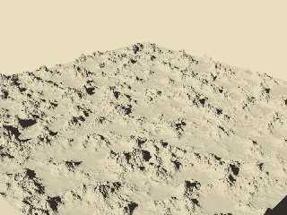
During the last months, I experimented with various isosurface (and
pattern) functions to generate realistic-looking landscapes. To
"navigate" around these landscapes (e. g. for placing cameras or, in the
future, trees or buildings) I found it necessary to have an orthographic
map view of the terrain at different scales.
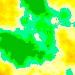
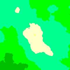
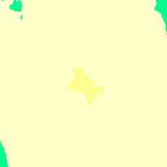
But at very large scales such as 1 by 1 kilometres (whis equals to 1
metre/pixel at my favourite rendering resolution - see last attachment)
a problem occurs: as the human eye's ability to discern hues is limited,
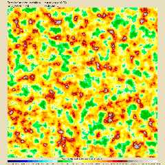
I have to adapt the color_map for the original 200 by 200 kilometres
physical map to the height range of the respective large-scale section.
To do this, I would have to know the highest and lowest point of the relief.
How could this be achieved? The highest point could be tested for by
shooting a series of parallel horizontal trace() rays from one edge of
the map section, starting at a height well above the highest mountains
in the whole isosurface (for example 15 kilometres), going lower each
iteration until the first mountain peak is hit. But how to this for the
lowest point?
And, after all, I'm sure that this method would be outstandingly
time-consuming - is there any way to do it faster?
See you in Khyberspace!
Post a reply to this message
Attachments:
Download 'ghurghusht_flat_0103b_wrinkles_oblique_view.jpg' (126 KB)
Download 'ghurghusht_flat_0103c_wrinkles_physical_map.jpg' (259 KB)
Download 'ghurghusht_flat_0105a_wrinkles_regional_map.jpg' (93 KB)
Download 'ghurghusht_flat_0105b_wrinkles_local_map.jpg' (33 KB)
Download 'ghurghusht_flat_0105c_wrinkles_microlocal_map.jpg' (12 KB)
Preview of image 'ghurghusht_flat_0103b_wrinkles_oblique_view.jpg'
Preview of image 'ghurghusht_flat_0103c_wrinkles_physical_map.jpg'
Preview of image 'ghurghusht_flat_0105a_wrinkles_regional_map.jpg'
Preview of image 'ghurghusht_flat_0105b_wrinkles_local_map.jpg'
Preview of image 'ghurghusht_flat_0105c_wrinkles_microlocal_map.jpg'
|


![]()