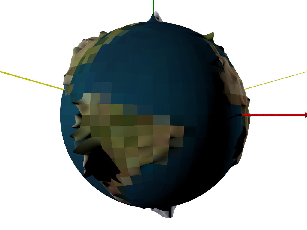
A bit more progress:
Got the cartesian to spherical to uv conversions worked out, used the mapping to
look up altitude at any given point, and have bezier arrays for each of the
tiles. Using the mapping to sample the center rgb value of a tile from a color
world map gave me a rough value which hopefully may be used to automate terrain
designations and texture definitions.
I overrode the random format assigned to the tiles, and made them all bezier
patches - about 1500. Elevation is greatly exaggerated (x300). Can render as a
wireframe of bezier splines, and still have to work out how to generate the
appropriate heightfields from the world map for the individual tiles.
Post a reply to this message
Attachments:
Download 'myplanet.png' (137 KB)
Preview of image 'myplanet.png'
|