|
|
|
|
|
|
| |
| |
|
|
|
|
| |
| |
|
|
?UTF-8?Q?J=c3=b6rg_=22Yadgar=22_Bleimann?= <yaz### [at] gmx de> wrote:
> What vertical exaggeration factor did you use?
I suppose you could figure a way to scale to meters,
DEMPOV says its
[12] elev. min: 0.00000, max: 1646.00000
north
and
[12] elev. min: 0.00000, max: 4206.00000,
"hawaii-c"
there were 5 for the big island, never viewed them separately, doh. de> wrote:
> What vertical exaggeration factor did you use?
I suppose you could figure a way to scale to meters,
DEMPOV says its
[12] elev. min: 0.00000, max: 1646.00000
north
and
[12] elev. min: 0.00000, max: 4206.00000,
"hawaii-c"
there were 5 for the big island, never viewed them separately, doh.
Post a reply to this message
|
|
| |
| |
|
|
|
|
| |
| |
|
|
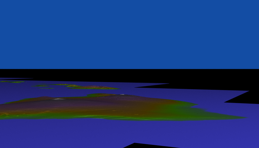
previous hawaii2.gif just limps along painfully.
this one is easier on the eye,
I dont get the reason yet.
3.7 woo hoo
Post a reply to this message
Attachments:
Download 'hawaii.gif' (3623 KB)
Preview of image 'hawaii.gif'

|
|
| |
| |
|
|
|
|
| |
| |
|
|
at equator 1 deg = 111.32 km = 111320
the island is 93 miles (150 km) 150000
111320 / 4206 = 26.466952
300 / 26.466952 = 11.33489
my scale is <300,11.335,300>
(if a map vertical Scale of 15, still made a 1x1x1 model.)
still testing these things
Post a reply to this message
|
|
| |
| |
|
|
|
|
| |
| |
|
|
"Melody" <nomail@nomail> wrote:
> at equator 1 deg = 111.32 km = 111320
> the island is 93 miles (150 km) 150000
>
> 111320 / 4206 = 26.466952
> 300 / 26.466952 = 11.33489
>
> my scale is <300,11.335,300>
>
> (if a map vertical Scale of 15, still made a 1x1x1 model.)
> still testing these things
note that the camera starts at a height of 50.
all tiles scaled to <300,50,300>
as the camera flies past a peak of 50 at 50,
I get a sense something very accurate is happening
with DEMPOV regardless of image vertical scale.
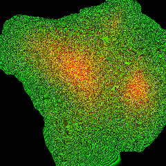
if vertical scale is too high, the image is solid yellow. no data.
Post a reply to this message
|
|
| |
| |
|
|
|
|
| |
| |
|
|
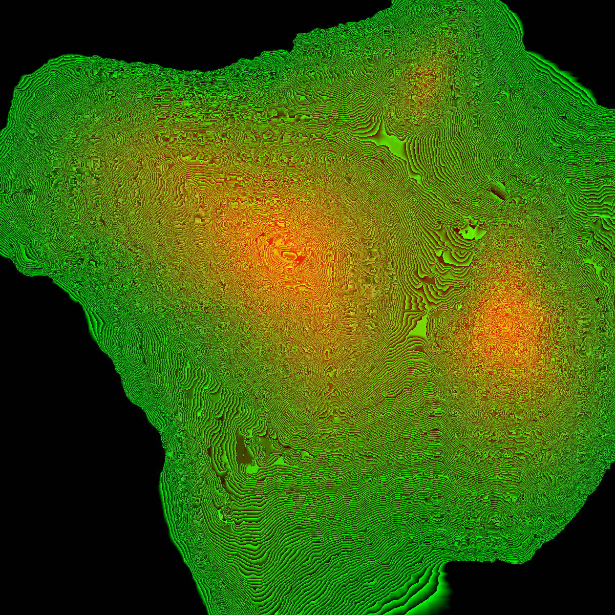
I suspect map vertical scale of 15 was a lucky guess.
red hits the model height of 1, so scale to 50 hits 50 for Hawaii-c.
here's what I mean, picture is worth ... black green red
Post a reply to this message
Attachments:
Download 'hawaii-c.jpg' (584 KB)
Preview of image 'hawaii-c.jpg'
|
|
| |
| |
|
|
|
|
| |
| |
|
|
so the magick number, for every cube at 1x1x1.
xscale / 26.467 = yscale
long as you have black green red ...
find highest vertical scale,
tallest model's image hits red.
Post a reply to this message
|
|
| |
| |
|
|
|
|
| |
| |
|
|
111320 /
lowest to highest elevation in meters =
if you got that number, u know your scale
its a 1x1x1 cube if your map verticalscale was black green red.
Post a reply to this message
|
|
| |
| |
|
|
|
|
| |
| |
|
|
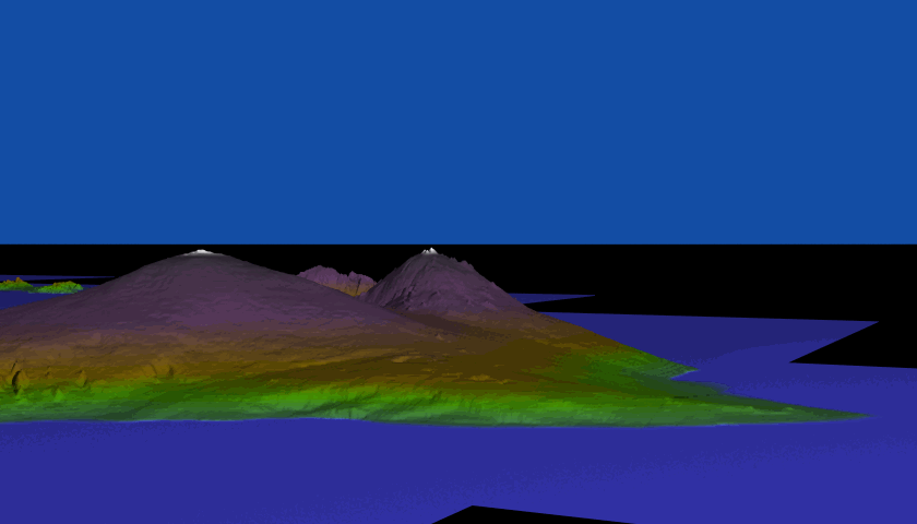
the numbers suggest this to scale
Post a reply to this message
Attachments:
Download 'kauai_an5.png' (122 KB)
Preview of image 'kauai_an5.png'

|
|
| |
| |
|
|
|
|
| |
| |
|
|
Op 09/12/2019 om 12:20 schreef Melody:
> the numbers suggest this to scale
>
Yes! This looks right indeed!
--
Thomas
Post a reply to this message
|
|
| |
| |
|
|
|
|
| |
| |
|
|
"Melody" <nomail@nomail> wrote:
> the numbers suggest this to scale
Based on photos I've seen of Mauna Kea, this looks accurate.
Post a reply to this message
|
|
| |
| |
|
|
|
|
| |